Tag Archives: uav

xyHt Digital Magazine: April 2025
xyHt magazine’s April issue focuses on surveying and takes an in-depth look at the modern state of the art of surveying. As always, if you don’t have a subscription to our print edition, or if someone else in the office has snaffled your copy, don’t fret, here is the digital edition. Click here or on the cover...
xyHt Digital Magazine: Feb/Mar 2025
xyHt magazine’s February/March issue highlights mapping and surveying and takes an in-depth look at a few issues involving both. As always, if you don’t have a subscription to our print edition, or if someone else in the office has snaffled your copy, don’t fret, here is the digital edition. Click here or on the cover to the...

Shruthi Srinivasan – 2025 Young Geospatial Professional
Company: Texas A&M Forest ServiceCurrent position: Geospatial Analyst & LecturerAge: 34 Education: MS in forestry, Texas A&M University; BE Geoinformatics, India Srinivasan is a geospatial analyst, an FAA certified UAV pilot with the Texas A&M Forest Service, and provides geospatial expertise at national-level disasters. As part of the Spatial Solutions group, she performs timely spatial analyses...
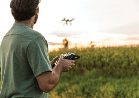
Part 108 Where Are You?
What impact will allowing flights beyond the visual range of the operator have on the mapping industry?
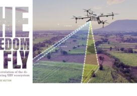
The Freedom to Fly
The Freedom to Fly: The real-time evolution of the direct georeferencing UAV ecosystem
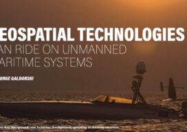
Geospatial Technologies Can Ride on Unmanned Maritime Systems
For years, professionals in a wide range of fields—from oceanography to hydrography to ocean mapping, to deep sea mining and many others—have depended on geospatial technologies to help gather and analyze various aspects of the makeup of the oceans. Advances in this field have been well-documented in the pages of xyHt