Tag Archives: surveying

It’s a Small (Sensor) World
The fascinating emerging world of geophysical and geological exploration with drones For the last 10 years we have seen more and more applications adopting uncrewed aircraft or drones and adding them to their workflows to expand businesses and offer more versatility to their customers. But like in every other new technology, adoption is not uniform,...

What’s New EagleView?
A conversation with EagleView CEO, Piers Dormeyer about aerial imaging markets, value-added services, and what role could, and is playing in the sector.

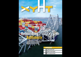
xyHt Digital Magazine: July/August 2024
xyHt magazine’s July/August 2024 issue focuses on surveying and mapping, with an in-depth look at a map maker of the future and a profile of up-and-coming Stonex. As always, if you don’t have a subscription to our print edition, or if someone else in the office has snaffled your copy, don’t fret, here is the digital...

xyHt Weekly News Recap: 06/28/2024
The Black Cape Scholarship for Women in Geospatial Intelligence EUSI Delivers SAR Imagery to DLR for Rapid Mapping of Southern Germany Floods Smart Cities Increase Drone Usage Worldwide Woolpert to Collect Aerial Lidar Data Across So. California for USGS Surveying Equipment Market size is set to grow by USD 2.72 billion from 2024-2028
xyHt Digital Magazine: June 2024
xyHt magazine’s June 2024 issue focuses on hydrography in the geospatial world. As the oceans become increasingly important and the “blue economy” grows, the topic is becoming more important to understand. As always, if you don’t have a subscription to our print edition, or if someone else in the office has snaffled your copy, don’t...

Are Surveyors Professionals or Merely Technicians?
Legal Boundaries This is a question that has haunted the surveying profession for years if not decades. A second related question is: What’s the difference? Curtis Brown addressed this issue in an article he wrote that in 1961 that was published in the ACSM’s Surveying and Mapping magazine, entitled “The Professional Status of Land Surveyors.”...