Tag Archives: surveying
Critical Issues for GIS/Survey Cooperation
State Plane Coordinates in Legal Descriptions The time is now to have State Plane Coordinates (SPC) attached to key monuments that should be part of just about any legal description, in the proper context.* This has been discussed since the early 1980s and has been accomplished only on a piecemeal basis. With coordinate inclusion, a...

Heads-up Hard Hats
A new smart helmet brings VR to the workplace. Virtual Reality (VR) and “wearables” are all the rage now, but we expect the hype to subside at some point, and then we’ll start seeing products suitable for real-world applications. Sure, there is Glass and Oculus, but how can such devices move beyond gaming, marketing, (and...

Bilby Tower Dedication Honoring Jasper Sherman Bilby
June 14, 2014 was a perfect sunny Saturday in Osgood, Indiana, where many people gathered to dedicate the last known complete survey tower and honor Jasper Bilby, the USC&GS reconnaissance man who had designed it. They included surveyors from more than a dozen states, current and retired employees of the United States Coast and Geodetic...

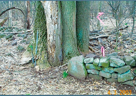
Kennemerland: Repositioning a Dutch East Indiaman
The Kennemerland is now designated as a Historic Marine Protected Area on account of the national importance of the wreck. Recently I was part of a team of archaeological divers sent to Out Skerries by Cotswold Archaeology on behalf of Historic Scotland. We were tasked with checking, updating, and geo-referencing the existing plans of the...
NC PLS Grandfathering Provision for GIS Professionals
In order to adapt to a whole new contingent (GIS), NCBELS formalized GIS Inclusion/Exclusion Guidelines for what GIS work fits under the definition of surveying in 2008 and created the Mapping Sciences Exam in 2009 as an alternative exam that focuses on areas of the surveying profession that GIS professionals would work with.
Rules of the Game: Reading and Writing Legal Descriptions: A Survey and GIS Joint Perspective
By F. Peirce Eichelberger and J. Peter Borbas We developed a one-day GIS/survey workshop in 2013-2014 (a new URISA/GLIS workshop), and from that a half dozen topics arose of particular interest to both surveyors and GIS professionals[1]. One issue near the top was legal descriptions. With both surveyors and GIS/mapping staff intimately involved with legal...