Tag Archives: surveying
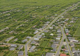
Advancements in Parcel Mapping Tools – Part 1
Whether a parcel map is created for an engineering project, land development, valuation, tax assessment, land administration and management, for a subdivision, city, county, or whole country, the tools to create and manage them have dramatically improved.

What is an Accurate Survey?
The surveying profession has always been a measure-centric profession. What I mean by that is surveyors love their measurements, and that is where the primary focus of surveying practice has been concentrated from the very beginning. We have always been the expert measurers in the room. We can analyze our measurements, run closures, make adjustments,...

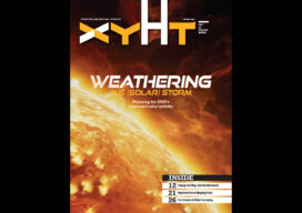
Weathering Solar Storms
Entering the peak year of the current Solar Cycle, GNSS users are already experiencing negative effects. The good news is that there are planning resources, and many of today’s advanced rovers can ride out all but the roughest solar storms.
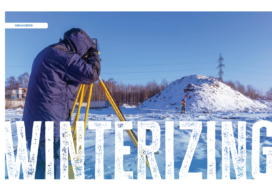
Winterizing
For surveyors, snow and cold can be a real impairment to field work. To some, who choose to bundle up and work through some snow squalls, it may not be as detrimental as rain for completing the field work, but it can still cause a lot of problems.
xyHt Digital Magazine: Feb/Mar 2025
xyHt magazine’s February/March issue highlights mapping and surveying and takes an in-depth look at a few issues involving both. As always, if you don’t have a subscription to our print edition, or if someone else in the office has snaffled your copy, don’t fret, here is the digital edition. Click here or on the cover to the...

Farid Hode – 2025 Young Geospatial Professional
Company: Trimble Inc. Current position: Sales EngineerAge: 25 Education: BS geomatics engineering, the University of Calgary Hode began his geospatial career at the University of Calgary, where he gained a strong knowledge of geomatics. As an active member and part of the council of the Geomatics Engineering Student Society, he honed his leadership and collaborative skills. During...