Tag Archives: QGIS

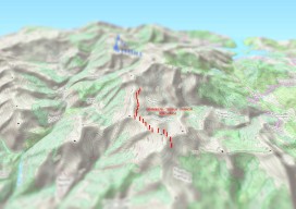
Create an Awesome 3D Map in Minutes in #QGIS
Until recently, 3D has been a bit of a gimmick to the everyday GIS user, by this I mean that it has been quite time consuming to create a GOOD 3D representation (easily) until now. I’ve used some great 3D software whilst working on survey data and also visualisation of environmental impacts, Fledermaus, ArcScene, Sketchup,...
