Tag Archives: mapping

xyHt Digital Magazine: April 2025
xyHt magazine’s April issue focuses on surveying and takes an in-depth look at the modern state of the art of surveying. As always, if you don’t have a subscription to our print edition, or if someone else in the office has snaffled your copy, don’t fret, here is the digital edition. Click here or on the cover...

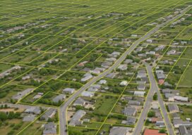
Advancements in Parcel Mapping Tools – Part 1
Whether a parcel map is created for an engineering project, land development, valuation, tax assessment, land administration and management, for a subdivision, city, county, or whole country, the tools to create and manage them have dramatically improved.

xyHt Digital Magazine: Feb/Mar 2025
xyHt magazine’s February/March issue highlights mapping and surveying and takes an in-depth look at a few issues involving both. As always, if you don’t have a subscription to our print edition, or if someone else in the office has snaffled your copy, don’t fret, here is the digital edition. Click here or on the cover to the...

Change the Map and Join the Movement
Craig Allan, chairperson of OpenStreetMap Foundation, talks about helping run the world’s biggest community mapping project, working with artificial intelligence, and why after two decades there are still unmapped places

xyHt Weekly News Recap: 11/01/2024
Topcon Announces Topnet Live Coverage Expansion Across Western U.S., Hawaii Pioneering Tomorrow’s Infrastructure: Highlights from Bentley Systems’ Year In Infrastructure (YII) 2024 Official Geospatial Data Helps Copernicus Map Emergency Responses to Extreme Weather Strong Outlook for Global Sensor Market: Set to Exceed US$250B by 2035 Teledyne Geospatial to Present Preview of Coastal Mapping Solution at...

Better Wine with GIS
One of the best vineyards in the world receives care and correction guided by smart maps
