Tag Archives: hydrographic
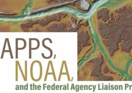
MAPPS, NOAA, and the federal Agency Liaison Program
This is the second in a series of four articles that highlights the MAPPS Federal Agency Liaison Program with federal agency partners and specifically with the National Oceanic and Atmospheric Administration (NOAA) where MAPPS member firms have a strong interest in programs, contracts, and ongoing collaboration. By developing and continuing impactful relationships with federal agencies...

xyHt Weekly News Recap: 06/02/23
Seabed 2030 and NORBIT Oceans to Accelerate Global Ocean Mapping Phase One Launches iXM-SP150 Space-Hardened Camera at GEOINT CartoVista Unveils Latest in GIS Web Mapping Platforms USGIF Announces Three New Scholarships Sponsored by St. Louis Organizations NOAA Hires Woolpert for Hydrographic Survey, Bathymetric Data in Nome, Alaska Commercial Drone Alliance and Commercial UAV Expo Announce...

Looking Forward: The Ocean
I have been fascinated by the ocean since my parents first planted me on a beach towel along the sandy expanse of the Atlantic Ocean when I was barely old enough to care. Like fire, the ocean is always the same but somehow is constantly changing. It has a mesmerizing quality of ever-flowing motion and...

Hydrospatial: The Next Frontier of Hydrography
Staying Fluid The theme for US Hydro 2023 reflects the relevance that our profession and related sciences have in the marine geospatial world. In some circles we are discussing the profile of “the hydrographer of the future” (the Canadian Hydrographic Service is leading a series of workshops on this topic), what they have to learn...
xyHt Weekly News Recap: 02/18/2022
Riegl Instruments Used by Projects that Win MAPPS Geospatial Excellence Awards Geo Week Exceeds Expectations Trimble Introduces Catalyst GNSS LAND INFO Announces Updated 10m USA Countrywide Land Use Land Cover Mapping Dataset XMAP Cloud GIS Brings Government Flexible Working Closer to Home Sonardyne Launch Wireless Seabed Unexploded Ordnance Disposal Capability Fugro Joins UN Ocean Decade...
xyHt Weekly News Recap: 02/11/2022
SBG Systems Introduces its First Tactical Grade IMU on the Market New Commercial BVLOS Milestone – Longest Distance Allowed by FAA at 12 Miles Phase One Launches iX Suite for Seamless Aerial Mapping Workflow Vexcel Introduces MapControl SDK to Help Developers Integrate Aerial Imagery New Surveying and Mapping Textbook Available for Download Vexcel Announces Image...