Tag Archives: GIS

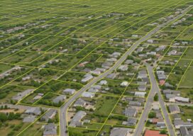
Advancements in Parcel Mapping Tools- Part 2
Whether a parcel map is created for an engineering project, land development, valuation, tax assessment, land administration and management, for a subdivision, city, county, or whole country, the tools to create and manage them have dramatically improved. In the past, a key sticking point for surveyors was the lack of solid COGO tools within legacy...

xyHt Digital Magazine: April 2025
xyHt magazine’s April issue focuses on surveying and takes an in-depth look at the modern state of the art of surveying. As always, if you don’t have a subscription to our print edition, or if someone else in the office has snaffled your copy, don’t fret, here is the digital edition. Click here or on the cover...

Advancements in Parcel Mapping Tools – Part 1
Whether a parcel map is created for an engineering project, land development, valuation, tax assessment, land administration and management, for a subdivision, city, county, or whole country, the tools to create and manage them have dramatically improved.

xyHt Digital Magazine: Feb/Mar 2025
xyHt magazine’s February/March issue highlights mapping and surveying and takes an in-depth look at a few issues involving both. As always, if you don’t have a subscription to our print edition, or if someone else in the office has snaffled your copy, don’t fret, here is the digital edition. Click here or on the cover to the...

Farid Hode – 2025 Young Geospatial Professional
Company: Trimble Inc. Current position: Sales EngineerAge: 25 Education: BS geomatics engineering, the University of Calgary Hode began his geospatial career at the University of Calgary, where he gained a strong knowledge of geomatics. As an active member and part of the council of the Geomatics Engineering Student Society, he honed his leadership and collaborative skills. During...

Matthew Forrest – 2025 Young Geospatial Professional
Company: Wherobots Current position: Director of Customer Engineering and Product-Led GrowthAge: 36 Education: BA geography and sociology, University of Wisconsin-Madison Forrest is a passionate leader in modern GIS, dedicated to empowering others to adopt cutting-edge tools and methodologies in geospatial workflows. With more than 13 years of industry experience, Forrest has established himself as a thought...
