Tag Archives: geospatial

Weekly xyHt News Links: 2/28/20
LIDARUSA Completes Integration of Optech CL-360 New Power BI custom visual for embedding interactive maps GeoIgnite 2020 Tracks, Summits, and Forums Announced Intuicom Releases Its Newest RTK Bridge®-X Industry Report: The Geospatial Industry is Alive and Kicking

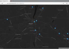
Creating a Web Map Using Mapbox
This blog is born out of pure frustration and my competitive nature. When I was looking at web mapping libraries, I looked at Mapbox and thought, “That will be easy.” Three days later I was pulling my hair out—then the next day I was smiling and happy. You see, Mapbox is similar to Leaflet in...

What Is PostGIS Day?
For the last 20 years, we have celebrated GIS day along with Esri. It is a great opportunity to get people who haven’t used GIS or mapping before in your office to have a look at what you do and maybe share a map cake (Note: It is traditional for GIS professionals to make a...

Ocean Business 2019
With preliminary surveys already starting around the coast of the UK for another round of wind farms being built, the offshore industry descended on the National Oceanographic Centre in Southampton, UK for the bi-annual event, Ocean Business, centered around the offshore survey industry. Luckily, my home is a walk away from the event, so I was more than happy...

Creating Album Covers with GIS—or Drawing Elevation as Vector Lines
In July 2014, a developer and neocartographer from Scotland created the “Joy Divionesque 3D Map.” This began a four-year onslaught of maps that replicate the style of the iconic Joy Division album cover, “Unknown Pleasures.” How does it work? Essentially the elevation is taken from an underlying terrain or digital surface map as points, which...

In The News: A Geospatial Year at Woolpert 2017-2018
Woolpert has been in business for 107 years, building a strong, broad-based foundation through engineering, surveying, mapping, photogrammetry, lidar collection, GIS, etc., to provide the most comprehensive geospatial support in the industry. In the past year alone our work in each of these sites, represented by these red dots, were spotlighted in the press. They...
