Tag Archives: geospatial

xyHt Weekly News Recap: 08/12/2021
For the 2nd year in a row, Aero-Graphics is included in Inc. Magazine’s List of the Top 5000 US companiesAEM President Dennis J. Slater to Retire after 23 Years as President Fugro Answers Remote Geo-data Needs with New Uncrewed Capability NV5 Geospatial Launches Trim Optimization Esri Offers Free Online Course on Cutting-Edge Imagery Capabilities Innoviz...

xyHt Weekly News Links: 07/30/2021
Trimble Boosts Flagship RTX Correction Services Performance Common Ground Alliance Releases Newest Edition of Best Practices Guide North Dakota DOT Selects GeoCue for UAS Program Esri to Expand Geospatial Innovation in St. Louis Area Commercial UAV Expo Exhibit Floor Nearly Sold Out dSPACE and Cepton Partner to Provide 3D Lidar Simulation infiniDome Debuts Anti Jamming...

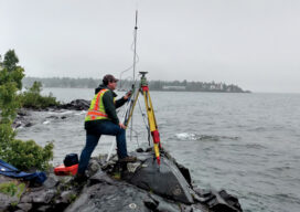
Teaching the Future
A small university on Michigan’s Upper Peninsula is educating the next generation of surveyors and geospatial engineers

xyHt Weekly News Recap: 07/09/2021
BlackSky’s Technology Monitors Iranian Nuclear Facility Microdrones and GE Launch the GE Industrial Drone Line Ag Department Selects NV5 Global for Geospatial Forestry Contract Graphisoft Releases Archicad 25 Uni-Pact USV Empowers FMS Next-gen Survey Work Esri Announces 2021 ArcGIS Online Competition Winners Satellite Imagery Company Satellogic to Go Public Through Merger New Software System Aims...

Saving the Big Cats with GIS
Location intelligence is helping livestock herders and lions peacefully share the land in Africa

xyHt Weekly News Recap: 06/04/2021
The Earth Archive Virtual Congress – Complimentary Registration ASPRS Announces Government Services Scholarship Pix4D Celebrates 10 Year Anniversary Virtual Surveyor Enhances Stockpile Reporting in Drone Surveying Software CGA’s Fourth Annual Technology Report Details Vision for Ideal 2030 Excavation CATALYST Collaborates with Amazon Web Services to Deliver Geospatial Insights New Mapping Tool Helps Parks Plan for Climate...
