Tag Archives: esri

Edgar Barreira
GIS Strategist and Natural Resources Account Manager, Esri Portugal As the Portuguese representative of Young Surveyors Network, account manager at Esri Portugal, business consultant, and owner of a small company, Edgar Barreira is a true young entrepreneur. At Esri, Edgar develops GIS strategies for customers’ needs; manages, identifies, and generates sales opportunities and assists in...

Virtualization: the Greatest Tool You Don’t (Currently) Use
This post is dedicated to a good friend, Chris Johnson, who, when we worked together a few years back, introduced me to this cool new word: VIRTUALIZATION. You see, Chris is an IT guru (see: enterprise systems architect)—a friend that every GIS guru should have so that you’ve got someone to pick up the pieces...

xyHt Weekly News Links: 11/17/17
EdgeTech Introduces New OEM Acoustic Release Components for Customizable Underwater Release Packages Esterline CMC Electronics and NovAtel® partner on new aviation certified GNSS Receiver Hemisphere GNSS Debuts A222 Scalable GNSS Smart Antenna Hemisphere GNSS Announces Atlas® Basic – Instant Global Sub-Meter Positioning for Atlas-Capable Hardware Intuicom Announces Bluetooth BRIDGE™ Engineered Specifically for Autodesk® BIM 360...

The Problem with GIS and Augmented, Virtual, and Mixed Reality
Over the last few years, altered realities technology has exploded, and now, with the introduction of Apple’s ARKit and Android’s ARCore, AR, MR, and VR are well within the reach of the non-developer. I can confirm this as I’ve created a few AR apps and MR apps myself over the last few months, with no experience...

xyHt Weekly News Recap: 7/14/17
From the International Cartography Conference (ICC 2017) ‘Maps Are Alive’: Highlights from the Esri UC plenary

Multipurpose GIS with ArcGIS Pro
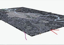
You can now use point clouds and massive geospatial data with GIS through the web and your desktop with new software. Above: London rendered in 3D with London Underground data. For years, point clouds (lidar, laserscan, and multibeam) have been pretty useless to GIS users. When a GIS user had to analyze the data, often...
