Tag Archives: DEM

What AI Can Do for GIS
Part 2 By Juan B. Plaza and Giulio Maffini Before we can even attempt to describe what AI can do for GIS, we need to understand what a GIS is and how it is used. What do these three letters mean? A pretty good definition is: A geographic information system consists of integrated computer hardware...

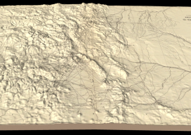
Hayden’s Survey in 3D
Above image: Hayden’s triangulation survey map is overlaid on a digital elevation model. A GIS project visualizes the fascinating triangulation network created for the historic Hayden survey of Colorado. One of the great surveyors in the American West is undoubtedly Ferdinand Vandeveer Hayden. A physician during the Civil war, he rose to be chief medical...
