Tag Archives: cadastral

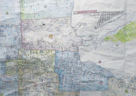
Advancements in Parcel Mapping Tools – Part 1
Whether a parcel map is created for an engineering project, land development, valuation, tax assessment, land administration and management, for a subdivision, city, county, or whole country, the tools to create and manage them have dramatically improved.

Derek Abernethy
23 Young Geospatial Professionals to Watch in 2023 – 10 of 23 Name: Derek AbernethyCompany: Trimble, Inc.Current position: Software product manager, vertical construction applicationsAge: 26 Education: BS in Engineering with honors, York University in Toronto, Ontario Abernethy’s work experience prior to entering the geospatial industry was in heavy civil and house construction where he...
Geospatial PPPs
Striking the right balance in building national cadasters with private/public partnerships. Land ownership is a foundation of national economies: those who have land titles can use them to obtain credit (which is often essential to start and expand businesses), and property taxes are a key source of government funding. Therefore, authoritative and efficient land registries...