Tag Archives: BIM

No Job Is Too Big or Too Small
Alexandra Grounds, Founder & Director, Grounds Associates, Ltd. Editor’s note: In this year’s Outlook issue, we present trends in geospatial technologies and vision statements from key geospatial industry firms, but we also highlight smaller operations: the agile, tech-savvy, and talented practitioners and their teams. As the need for geospatial data and expertise grows, career paths...
Angélica Ortiz Arteaga
BIM Director, IUYET Consortium Mexico A particularly impressive presentation at HxGN 2017 was by the IUYET Consortium about their work on the new airport rail project in Mexico City. The contributions of IUYET in the use of advanced surveying, scanning, mobile mapping, UAS, GNSS, and construction monitoring are splendid examples of the 21st century digital...

Infrastructure, BIM, and the Brothers Bentley
Infrastructure—the human footprint on the planet, the processes, systems, instrumentalities and built environment we inhabit—makes our lives possible. It provides the foundation for the lives we hope to live in the near and distant future. Modern infrastructure is the global tendrils of humanity, reaching all corners of the globe and binding us together in our...

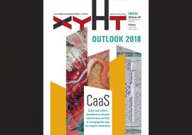
xyHt Magazine January 2018 Issue
Click on the cover below to view the January 2018 issue of xyHt magazine. Articles in the issue include (links will turn live throughout January): Infrastructure, BIM, and the Brothers Bentley: Meeting the needs of the global infrastructure boom, Bentley Systems has forged technology partnerships; moved to erase the workflow barriers among surveying, engineering, and construction; and...

BIM and Reality Modeling
Working examples of BIM workflow optimization using reality capture techniques. Editor’s note: Until recent years, BIM has been a difficult subject to consider; many AEC practitioners had not yet been involved in a BIM-executed project. But today, globally, BIM advancements have become prevalent for many large-scale infrastructure projects. We at xyHt emphasize two aspects of...
The iCon build: Adding Adaptable Options for Layout Automation
Leica’s “iCon build” solves a common layout automation conundrum for vertical construction firms, large and small. Editor’s note: The benefits of automation for vertical construction are not limited to projects that have implemented full-on, single-environment BIM. Many firms and projects can now use a realistic and practical mix of old and new workflows and technologies during...