Tag Archives: 3D

Morphing Landscapes
Normally we create digital surface models (DSM) and elevation models (DEM) to analyze the topography and visual issues related to a project or issue. The requirement for accuracy and precision is paramount, ensuring that the correct method(s) of converting the data from raw source to an accurate model is more a work of art than...
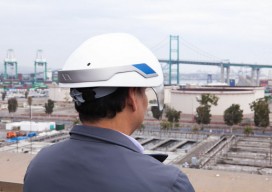
Heads-up Hard Hats
A new smart helmet brings VR to the workplace. Virtual Reality (VR) and “wearables” are all the rage now, but we expect the hype to subside at some point, and then we’ll start seeing products suitable for real-world applications. Sure, there is Glass and Oculus, but how can such devices move beyond gaming, marketing, (and...
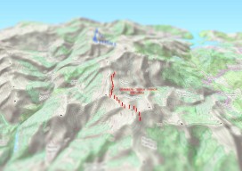
Create an Awesome 3D Map in Minutes in #QGIS
Until recently, 3D has been a bit of a gimmick to the everyday GIS user, by this I mean that it has been quite time consuming to create a GOOD 3D representation (easily) until now. I’ve used some great 3D software whilst working on survey data and also visualisation of environmental impacts, Fledermaus, ArcScene, Sketchup,...