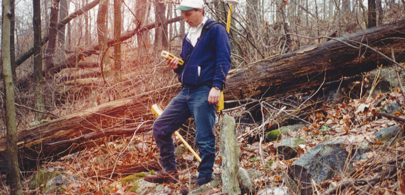
What better time of year to be in the field than the fall in the northern part of the United States? The daylight hours are shorter, but the air is crisp and the warmth from the sun feels great. In fact, it’s just a great time to be outdoors.
This is the time of year when there are all types of festivals with various themes, whether they are focused on harvesting crops or fall foliage, crowds of people swarm outdoors to enjoy the great season.
Farmers are busy with the harvest as they gather in the last of the corn, grain, and soybeans. In my neighborhood, apples are a huge part of the harvest and apple harvest festivals abound in various styles.
It is also the time that hunters get their chance to try out their new equipment. They have already spent their money on new bows, arrows, firearms, clothing, scents, etc. anticipating the climb into that tree stand to wait for the large, antlered deer they seek. This too is another form of harvesting, as they stock the freezer for the winter.
For the surveyor, the advantages to being afield, are not only for the nice weather, but also because the leaves start dropping in the deciduous woods across the northern United States. The lack of foliage certainly allows the surveyor to gain a clear line of sight without cutting a lot of brush, it also gives a clearer view to the sky for GPS signals to get through to the receiver.
Many years ago, I was assigned to perform a boundary survey on the ridge of South Mountain along the Appalachian Trail in Maryland. This area consisted of various tracts of land along a five-mile stretch of the trail. We had two clients for this project, the National Park Service and the Maryland Department of General Services. These two agencies owned many tracts which draped across the mountain. The reason for the survey was to establish a publicly owned corridor along the Appalachian Trail.
It was decided we should wait until fall when the leaves came off the trees providing huge cost savings for both agencies. This all had to be tied to the Maryland State Plane coordinate system, so GPS was to be used to set up some baselines to get started. We were still using dual-phase receivers to run static sessions and establish control.
The unique thing about the properties owned by the state is that, starting in the 1970s, they required surveys of their land to be tied into state plane grid. This was convenient for us because several of the tracts within our scope of work had geo-referenced coordinates on them.
While doing the deed research and plotting the deeds into AutoCAD over the summer in preparation for the survey, we were able to set up the deed mosaic roughly in real-world coordinates. The firm I worked for had a team of GPS experts, who helped me set up the project. They introduced me to a unit that used RTCM for differential corrections. After setting points in the drawing and uploading them to the unit, I was ready to go. This was exciting stuff for me as I imagined how easy this was going to make the reconnaissance of boundary corners.
We planned to meet at the southern end of the project with representatives from the state to coordinate our efforts and get the survey started. I was a bit apprehensive about how well the GPS was going to work in helping us find property corners. I arrived early to at least make sure I was receiving radio signals for the corrections. This was still during the time of selective availability, so without the maritime services signal, I could have been very far from my intended target coordinates.
When I arrived at the parking lot for Gathland State Park, got my equipment out and turned on the GPS unit, I discovered I had a good radio signal, so I started navigating to the nearest boundary corner. The targeted coordinates put me in a reasonable position, so I turned on the magnetic locator and started sweeping it in search of the corner. Within seconds, and just as the client representatives arrived in the parking lot, I found the called-for “T-bar”.
With the lack of leaves on the trees, we covered a large segment of boundary and found many of the old stone piles and planted stones along the wooded hillside. It was one of those “red-letter days” in the field, and I was enjoying the thrill of the hunt, as well as the cool weather.
Of course, as we enjoy this cool and dry weather, we all know that it is a harbinger of the cold winter, but let’s not think about that for now.

