
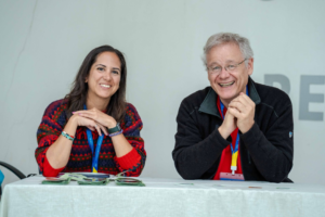
Craig Allan, chairperson of OpenStreetMap Foundation, talks about helping run the world’s biggest community mapping project, working with artificial intelligence, and why after two decades there are still unmapped places
Taking care of a 20-year-old can be quite a chore. But not for Craig Allan, the current chair of the OpenStreetMap Foundation’s board of directors. Together with six other board members, his job is to make sure that OpenStreetMap (OSM), the world’s largest crowdsourced geospatial project, continues to deliver on its promise to make mapping data accessible to everyone. In fact, he finds that being part of the OSM Foundation exciting.
“I am a fan of building good processes that help an organization deliver much more with a lot less effort,” says Allan, who is now on his third year with the OSM board. “OpenStreetMap could do so much more, and I want to take it there.”
Started in 2004 in London by Steve Coast to make free maps while riding his bike on Regent Park, OpenStreetMap is now all grown up. The mapping platform celebrated its 20th anniversary with mapathons hosted by various local OSM chapters from Australia to Japan.
OSM currently counts around 60,000 map requests per second from around the world, with users coming from various websites such as Meta, MapBox, Esri, and Tomtom, to ride hailing companies like Uber and Lyft. There is also a huge OSM community from humanitarian organizations and agencies under the United Nations.
“The OSM Project began as a response to the rigid copyright restrictions on the use of UK’s Ordnance Survey map series,” says Allan. This egalitarian approach of making maps more accessible was unheard of before that time, and it may have helped the public to easily warm up to the mapping project. Plus, there was a strong camaraderie among the first OSM contributors, recalls Allan. “The mapping application gained a good deal of popular support possibly because a lot of the early meetings were in pubs,” he says.
Craig Allan with Dani Waltersdorfer at the 2024 State of the Map Conference in Nairobi, Kenya. Waltersdorfer is secretary of the OSM Foundation and one of its seven board members.
Between tinkering with maps and toasting pints of beer, the OpenStreetMap project grew rapidly, reaching about 1,000 registered users by Christmas of 2005. A few months later in August of the following year, a group of early OSM contributors came together and formed the OpenStreetMap Foundation. Since then, the foundation has become the legal custodian of all OSM data and infrastructure.
Allan is in his 14th year as an OSM mapper. He has also worked as a professional urban and regional planner “with side gigs on anti-apartheid politics and a little software development,” he adds. The South African local still remembers his first OSM contribution which was fixing a map error near his childhood home in Durban.
“I love to map unmapped spaces, especially in Africa,” he says. “That’s because I know that being on the map greatly increases a rural village’s chances of receiving government and NGO services, which then leads to a big improvement in their quality of life.”
Allan is also a supporter of free open data and software, a passion that he carries with him at the OSM Foundation. Everyday the foundation encourages tens of thousands of mappers to gather geospatial data and save them in the foundation’s servers.
“The OSM then gives the data away for free to anyone who wants to use it,” he says. “I know it’s a strange business model, but it works really well.”
OpenStreetMap had its 20th anniversary last year. Tell us how you celebrated it?
We celebrated with birthday party events, with cakes and candles, where mappers came together to celebrate. There were more than 60 birthday events globally. Most of those were mapathons–a gathering of OSM enthusiasts for the purpose of mapping.
How are the OSM Foundation and OpenStreetMap related to each other?
OpenStreetMap is a big bundle of different things. We talk of the “OpenStreetMap Project” to describe the global movement of people who contribute data or use our data. The “OpenStreetMap Foundation” is part of that movement. The foundation is the governing body that supports but does not control the movement. If anything, the movement controls the foundation through lots of community review and feedback on everything that we do as a board.
What are the main activities of the OSM Foundation?
The foundation supports the OpenStreetMap project in a number of ways. The core role is to host and develop the hardware, software, and infrastructure for the delivery of OpenStreetMap. Without those computers, we are nothing.
The foundation has a board which is composed of seven members. And then there are eight working groups with about 84 members. Roughly 90 people are involved, but everybody is a volunteer. We only have one employee who keeps the IT systems running, plus three contractors who do administrative and software development.

Craig Allan, board chairperson of OpenStreetMap Foundation. Allan has been contributing to the OSM for 14 years. He is shown here with Obi, a friendly dog who has accompanied him in mapping trails.
And how does the OSM Foundation fund its activities?
To pay for the whole intricate workstream I just described, we have to do a lot of fundraising. Our fundraising efforts result in gifts in cash and kind that amount to a little over $1 million dollars every year.
We are a non-profit organization, and we get a lot of free stuff. Like the hugely valuable Content Delivery Network (CDN) is provided by the company Fastly. The load on the CDN servers varies by time of day, peaking currently at around 60,000 requests per second. That’s six gigabytes per second of traffic.
We also get free use of global satellite photos provided by Microsoft, Esri, and MapBox, which is a big donation. Then there are local aerial and satellite photography supplied for free by many government and private sources.
For our financial donors, the largest sums come from Tomtom, the Dutch navigation supplier, Microsoft, and Esri. We also get financial support from Meta. Some of the other big contributors are Mapbox, Grab, Komoot, and Gojek. Individual donors contribute a large amount as well. We don’t sell anything, and we don’t advertise on our sites.
Who are the main OpenStreetMap data contributors right now?
There are no stand-out contributors. The mapping activity is truly crowd-sourced, and it is the contributions of many individuals working separately that build the OSM database.
There are some organized mapping activities by companies like Apple, by the United Nations, by the Humanitarian OpenStreetMap Team, YouthMappers and many other groups. However, organized mapping doesn’t stand out above the contributions of individual contributors.
There are also some extraordinary individual contributors. One that comes to mind is the user “andygol” who has made almost 6 million changes to the map. However, mapping is not a competition. We deliberately don’t make mapping competitive by publishing scores because there is a real risk of attracting people who will add nonsense data to cheat their way to the highest score.
And who are its main consumers?
Our consumers are anybody who sees a map on the web or uses route planning. OSM data is used in multiple phone apps, Apple maps, Microsoft’s Bing maps, in many car navigation systems, in weather websites, on Wikipedia, as well as ride-hailing services and delivery services. If you have a pizza delivered, there is a reasonable chance that OSM data was used to plan and execute that delivery.
What then are the main challenges in making sure that the OpenStreetMap platform runs smoothly on such a large scale?
There are only two challenges really. Making sure the data comes in and making sure the data goes out. That is the role of the OSM Foundation Board–to make sure that those two things keep on happening.
Making sure that the data comes in is a matter of first providing a good culture of contributing data, and, secondly, providing the tools that make it possible to contribute. The culture and tools part can be unpacked some other time because it is very complex work. What is important to mention now is that much of that work is done by separate unrelated organizations which voluntarily organize mappers and by software developers who build mapping tools like JOSM and Rapid Editor.
The foundation does a lot of supporting work in-house, providing the Wiki to guide mappers and providing some community chat channels for mappers to talk about mapping. We have what we call the “Local Chapters and Communities Working Group” which organizes mappers around the world.
The other challenge of making sure that the data goes out is our organizational mission. Our business is to deliver free geospatial data. This type of work is much more technical. We run a lot of servers to gather and process incoming data, to store it and to process outgoing data. There is a suite of enabling software that makes all that possible.

OpenStreetMap celebrated 20 years of community mapping last year.
What technological changes are being implemented to make sure that the OpenStreetMap platform remains accessible to everyone who needs it?
We delegate software management to our “Engineering Working Group” and hardware and networking to the “Operations Working Group.” They are very cautious about changing software without good reason. The major change currently underway, in fact at trial stage, is delivering map tiles as vector data. This change will allow reduction in data size per tile on the network, and it will support far more flexible styling of tiles.
Practically it means that map data will arrive in the user’s browser faster and there will be many more ways the map can look. But one immediate advantage of better styling is to have maps available in a range of languages, which makes it much more accessible for many users. At the moment OSM uses only the local language. For example, I battle with reading the OSM map in Arabic speaking areas. We’re going to fix that and have multi-language maps.
And while we’re talking of accessibility, providing maps for people with different levels of vision is a big challenge. With vector tiles we can rapidly develop maps better suited to color-blind mappers. Researchers in the Netherlands are now working on developing printable tactile mapping for blind or low vision users. We’re monitoring that work because we would like everyone to have access to free maps.
With generative artificial intelligence technology becoming more widespread, what are OSM Foundation’s plans to make sure that community volunteer mapping is future-ready?
Our data is already widely used for training AI models that interpret aerial photography. One end-user AI product that is now being used for volunteer mapping is Rapid Editor developed by Meta. Rapid Editor is based on the popular iD editor. Rapid Editor supports human supervised AI feature recognition, which greatly speeds up the map tracing and tagging work. However, we do not currently allow unsupervised editing by AI.
Which sector do you think is OpenStreetMap making a big impact and why?
The big impact is in the commercial sector, as OSM underlies many commercial applications. For example, OSM is available as a free base layer in Esri’s products, so all Esri users are one click away from using OSM data. And most do take advantage of it. At the same time, four of the top five ride-hailing companies including Uber, Lyft, Ola, and Gojek all use OSM. Our fundraising efforts are mainly focused on persuading more commercial users to contribute to OSM.
It is not possible to do more than scratch the surface of who uses our data, but the very prominent users of OSM are the United Nations, the International Committee of the Red Cross, and Doctors Without Borders. The most public impact therefore of OSM is in humanitarian efforts, particularly the work of Humanitarian OpenStreetMap where their members work to rapidly map disaster areas and high-risk zones where catastrophes are likely to happen.
The public sector also uses our data, mostly in GIS-based mapping. This is far less high profile, but it is very widespread.
In your opinion, how has OpenStreetMap evolved in the last two decades?
Our users don’t contribute actual maps. They add detail to one existing map which still has a lot of gaps. Slowly the gaps are being filled, and the quality and detail of the data is also being improved. Our evolution is slow, but over two decades we see that the OSM map is filling up.
In Zurich, for example, every road, building, bicycle parking rack, and street tree is mapped. But in the Democratic Republic of the Congo, whole towns are still blank and full of unmapped spaces. We need more resources to speed up mapping in areas where people don’t have access to computers or even the Internet.
The big change in recent times is an increase in the need for corrections and updates. We know that no map is ever fully up to date. Some areas were mapped in OSM many years ago, and that data is now inaccurate. We need our users in well-mapped areas to revisit their mapping and to update road alignments, commercial uses, hours of opening, and so on.
So, I invite you to get involved. Go to the OSM website (osm.org), find your neighborhood and hit the edit button. Something there will be wrong, missing, or out-dated. Change the map, click save and you’ve joined the movement.