Arm your surveyors with the right tools
Today’s surveying is evolving, with the need to work smarter in order to compete. Just as chains and compasses gave way to early theodolites, necessity has proven the mother of invention with advancements into total stations, GPS and robotics — raising the bar on speed and precision. But geospatial professionals must also be prepared with tools that ensure success—no matter what challenge lurks around the corner.
 By leveraging innovative technology, surveying companies in turn are able to achieve new levels of productivity, elevating their reputations as capable experts who can capture reliable data anytime, anywhere — within tight timelines. Today, that door opens by having the latest GPS-enabled tools ready for challenges that require capabilities even beyond gold-standard options like RTN-service or RTK methods.
- 1990: Trimble introduces the very first robotic total station.
- 2011: The launch of Trimble RTX® eliminates the need for a base station
- 2014: Trimble launches CenterPoint® RTX built right into receivers
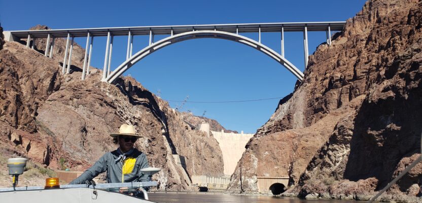
Case study 1: Real-Time Certainty Flows in the Colorado River
 Accuracy is pivotal to a myriad of projects requiring meticulous measurements wherever precise boundary delineations are required. Innovations in accuracy not only bolster the reliability of your surveys but also instill newfound confidence in the data you present to clients. But conditions aren’t always ripe for popular modalities to do the job. Accuracy must be achievable even amid the most massive and complex projects. That’s what one river engineering crew faced when looking for a solution to gauge critical data along the 342-mile Colorado River without needing to make pit stops to place or move base stations. Workflow and time constraints demanded a smarter solution, and the crew could not risk any signal interruption.
“Having used CenterPoint RTX before, we were confident it would be good. We didn’t know it was going to be that good.”
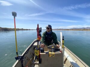
Case study 2: Maximizing surveying efficiency with Trimble CenterPoint RTX technology
Today, the bar has been raised, and surveyors are expected to be ready for anything. Arming teams with the tools that allow them to see around corners and adjust on the fly empowers them to turn complex situations into feasible tasks. When traversing difficult terrain is necessary, hardware failures and connectivity issues are a real concern. This reality prompted a senior operations manager at WGI to try something outside their toolbox. Just one trial day was all it took to realize the benefits of not needing to worry about base stations, unstable internet connections or equipment failures.
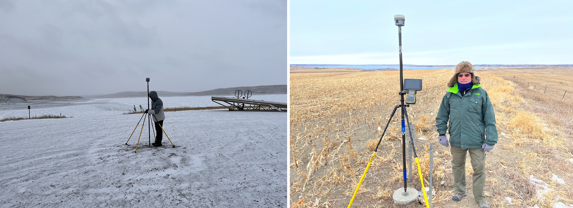
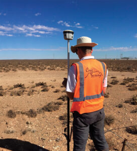
Case study 3: Surveyors Achieve Productivity and Accuracy Remotely with Trimble RTX
It’s not just where a job is that can create challenges; sometimes it’s the lay of the land, which was what a team at Cape Survey Ltd encountered while providing essential services for a new wind farm. While RTK provided excellent accuracy, its range was limited by rolling terrain, which blocked out radio signals, and regulations on radio output power further reduced performance. Having to create new control points and move base stations frequently would take too much time.
 Today’s jobs call for real-time satellite corrections that ensure both precision—even when line of sight is impeded. And sometimes there’s no room for stops and restarts, uncertainty or re-measuring.
Real-life scenarios like the ones outlined become non-issues if you have the right tools on hand to pick up the slack, taking the “what if” worries out of the equation.
The time to realize you need an additional tool is not after your project stalls. Experience the peace of mind that comes with knowing that CenterPoint RTX is built right in, available whenever you need it, at no added cost — for an entire year.
With Trimble CenterPoint RTX the only limit is how far you’re willing to go.
Trimble CenterPoint RTX rounds out your surveying toolbox with everything needed to get the job done, no matter what challenges arise. With both and VRS/RTK on board, productivity stays on track. Use traditional RTK methods when it’s feasible, and CenterPoint RTX when it’s not and achieve:
- Centimeter-level accuracy
- Accelerated operations
- Enhanced productivity
- Positioning insurance
- Fast convergence
- Worldwide availability
- Full constellation tracking
- Independence from base stations
- Untethered surveying
- RTK interoperability
Learn how you can put CenterPoint RTX to the test: rtx.trimble.com
