September 2024 Archives
Drone Operators vs. Land Surveyors

Drone Operators vs. Land Surveyors. Are we headed for a confrontation?
Signed, Sealed, and Delivered

From GIS to satellite remote sensing and street-level imaging, the latest geospatial technologies are behind every successful delivery, down to the very last mile.
The Freedom to Fly
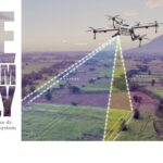
The Freedom to Fly: The real-time evolution of the direct georeferencing UAV ecosystem
Geospatial Technologies Can Ride on Unmanned Maritime Systems

For years, professionals in a wide range of fields—from oceanography to hydrography to ocean mapping, to deep sea mining and many others—have depended on geospatial technologies to help gather and analyze various aspects of the makeup of the oceans. Advances in this field have been well-documented in the pages of xyHt
Forest Architecture
To fully appreciate the significance of Jensen’s work, it’s essential to understand the traditional methods of tree surveys. In the conventional approach, a forest is systematically divided into sections using a grid. Then, a statistically representative sample of these sections is selected for detailed examination. This is done due to the time-consuming nature of the surveying process, which involves crews meticulously measuring trees for parameters like diameter, height, species, and signs of disease or damage.