News Archives
xyHt Weekly News Recap: 03/26/2021
Teledyne to Acquire FLIR Systems Drone Sets Endurance and Distance Record Can Lidar Improve Pedestrian Safety? Esri Recognizes Partners for Innovation and Excellence MapBusinessOnline Tracks USA’s COVID-19 Vaccination Progress Lidar and Smart Devices Can Help Find Victims of Natural Disaster Phase One Camera Designed for Infrastructure Inspection Global Surveyors Day 2021
xyHt Weekly News Recap: 04/02/2021
To Russia, and Back NV5 Acquires Geodynamics; Expands Deep-Water Capabilities CHC Navigation Introduces AlphaAir Lidar System Drone Company AgEagle had Record Year in 2020 SAM Acquires R&S Digital Services Bad Elf, Point One Provide Polaris GNSS Corrections for Bad Elf Flex
xyHt Weekly News Recap: 04/09/2021
Virtual Surveyor and Dropbox Form Partnership SkyTask Gets FAA Waiver for BVLOS Operations Amazon Becomes USGIF Strategic-Level Member
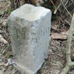
Farmer Accidentally Changes France-Belgium Border
Usually one country moving into another country’s territory is a huge geopolitical deal, often followed by military action. But when a Belgium farmer accidentally moved his country’s border into French territory, everyone just had a good laugh about it. The farmer was apparently annoyed by the boundary stone as he plowed his field, so he […]
xyHt Weekly News Recap: 05/14/2021
OCG Appoints 3 New Members to Board of Directors Bluesky, Lighthouse Surveying Map Contaminated Massachusetts Site Esri, IBM Team Up to Tackle Climate Change Small Scanner for Big Success Woolpert Sets Precedent for UAS at Airports Scotland Uses GIS to Boost Broadband in Rural Areas
xyHt Weekly News Recap: 05/21/2021
Teledyne Completes Acquisition of FLIR Trimble Introduces VRS Now Correction Services to Norway EOfactory.ai Scales Up Capabilities with CATALYST Microservices Skyward Introduces Mapping and Modeling powered by Pix4D Next GEOINT Service Day Series is June 9 Woolpert, Planet Partner to Deliver Imagery Worldwide Jack Dangermond Honored by IGU with Planet and Humanity Medal Bluesky 5cm […]


