June 2019 Archives
World’s Biggest Digital As-built?
Above: Darling 3D scanning division manager Charlie Warren checks his settings while scanning the Mercedes-Benz U.S. International automotive plant. A whopping 1.5-million square feet of a Mercedes-Benz facility expansion was scanned for as-built documentation and construction verification. A GROWING geospatial application of 3D digital data from laser scanners is for as-built documentation and construction verification. […]
A Truly Unique Scanner
A look at innovation in hardware, software, and workflow in the Leica RTC360. Not far from London in the UK is a place called Milton Keynes. Although it’s not as famous as places like Manchester, Birmingham, or Brighton, it is the home of the Red Bull Formula 1 team; it’s where WD40 is made; and […]
Refitting a Building in Continuous Operation
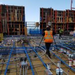
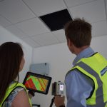
I’m a surveyor and technical specialist at Plowman Craven, one of the largest surveying companies in the UK. My company has worked closely with Leica Geosystems for more than 50 years, going back to the days of the T2 mechanical theodolite and DI10 EDM. Technology is different now, but the collaboration between our two organizations […]
The Latest in GIS Research
Newcastle University was host to the 2019 conference. Trends with UAVs, spatial data, and data use from GISRUK 2019. GISRUK is the annual GIS research conference in the UK that showcases the latest in GIS (geographical information science) and geomatics research from the UK and across Europe. I attended the four-day conference at Newcastle University, […]
Our Changing Oceans and Coasts
Students watch a pier demonstration—back row, l to r: Clayton Harbin, Troy Peterson, Max Crowe, and Jack Jamieson from NW Michigan College and Casey O’Heran from University of New Hampshire. In front is JT. Myers, an ocean engineer at Seafloor Systems. Highlights from the U.S. Hydro 2019 Conference The U.S. HYDRO 2019 Hydrographic Society of […]
Scanning Sensitive Slopes
A team collects data with the Polaris terrestrial laser scanner at an engineered slope within the Site C construction area. Laser scanning will be a critical tool for slope monitoring during nine years of construction for a hydro electric dam in a sensitive area of British Columbia. Construction was started on the Site C hydro […]


