Heights 2022 Archives
Providing Comprehensive Geospatial Solutions
Sanborn is a full-service geospatial company that has been in continuous operation since 1866. Today, Sanborn is an innovator in the modern geospatial industry, delivering state-of-the-art mapping, visualization, and 3D solutions for customers worldwide. Sanborn offers comprehensive geographic information solutions to city, county, regional, state, and federal government agencies, private companies, and international clients. Our […]
Woolpert Blends Methodology with Technology

What began as a four-person engineering and survey company in Ohio in 1911 has steadily evolved to become a full-service architecture, engineering, geospatial (AEG), and strategic consulting firm, with more than 1,600 staff and 60 offices on four continents. This fusion of AEG data breeds innovative products and solutions that address complex challenges worldwide, providing […]
Located to Mobilize Anywhere in the Continental U.S.

Midwest Aerial Photography is growing to meet our customers’ needs. Celebrating 32 years in business this year, we are capable of deploying a highly-skilled airborne data collection crew equipped with industry leading digital acquisition technology to any location in the United States and much of Canada on short notice. We take pride in our ability to […]
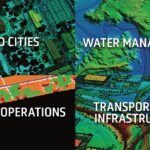
xyHt Magazine Heights 2022 Issue

Click on the cover to view the Heights 2022 supplement to xyHt magazine. Articles in the issue include: Mapping the Ocean: The need to map the surface of the ocean might seem odd, but as aerial technology advances, it is becoming more and more important. Manned Missions: In the age of unmanned aerial vehicles, the roll of the […]
Final Approach

The demise of a great mapping platform With the advent and adoption of new technologies, we are quick to forget about the old ways we used to do things. In the case of pocket calculators or disposable cameras is not relevant to reminisce about the past, but when the time comes to dispose of a […]
Geospatial Excellence
MAPPS recognizes the best geospatial projects of the year At its winter conference in Denver, MAPPS presented the annual Geospatial Excellence Awards to member firms whose entries exemplify the professionalism, value, integrity, and achievement of the firm’s staff as demonstrated over the previous year. The awards spotlight and honor the MAPPS members’ important and impactful […]