August 2018 Archives
A Fine Line

Notes from a visit to the new production facility for Topcon and Sokkia optical surveying instruments. I asked Tsutomu Ishibashi, a production line technician at Topcon’s Yamagata manufacturing facility, what message he would like to convey to the surveyors who use the products he helps produce. His answer was, “We are always trying to improve, […]
I-Shoku-Ju

A joint interview with Topcon president and CEO, Satoshi “Steve” Hirano, and Topcon Positioning Systems president and CEO, Ray O’Connor. I recently had an opportunity to sit down with Satoshi “Steve” Hirano, president and CEO of Topcon Corporation, for a candid interview at the company’s global headquarters (THQ) in Tokyo. The timing of this visit […]
What Can Spatial IT Do for You?

Helping firms meet the challenges of the global uptick in infrastructure development. Editor’s note: What is spatial IT? This umbrella term for the spatial component of the new wave of digital wizardry that’s transforming our geospatial and geomatics professions and industries can seem nebulous. xyHt has adopted the following working definition (as the term applies […]
Learning to Scan

An interior scan of an auditorium by undergraduate students gave them a thorough lesson. Florida Atlantic University (FAU) is the only school in the southeast that offers geomatics engineering, and the professor for the terrestrial laser scanning class, Dr. Sudhagar Nagarajan, asks a lot of his students to succeed. During this past spring semester (2018), we students had […]
How Accurate Is an RTN?
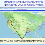
Many surveyors have realized the benefits of using real-time GNSS networks (RTN) for survey-grade positioning. Saving time, equipment, and personnel means saving project costs. The thing about real-time GNSS surveying, however, is that “rover expertise” needs to be applied in the field (not the office). Additionally, many factors involved with GNSS signalization, as well as […]
mESRIsoft
More than partners, Esri and Microsoft collaborate and combine platforms to benefit their users and the public. From their CEOs, Jack Dangermond and Satya Nadella, down to the individual developers and field sellers, Esri and Microsoft work together very closely. “We are connected at almost every level to each other’s companies,” says Lea Ann Thurman, […]