A substantial part of Switzerland’s water resources exist in its complex karst aquifers, a critical natural system that continues to pique the interest of researchers. At the Neuchâtel Centre for Hydrogeology and Geothermics (CHYN), a team of scientists led by Professor Phillipe Renard and accompanied by climate scientist Dr. Tanguy Racine launched an initiative seeking an in-depth understanding of these resources.
The objective was to study the physics of water flows within caves or underground karst conduits using state-of-the-art technology—specifically 3D laser scanning with the Leica BLK2GO and a customized lighting unit from Méandre Technologie—to bridge the gap in understanding aquifers that traditional measurement and modeling methods couldn’t cover.
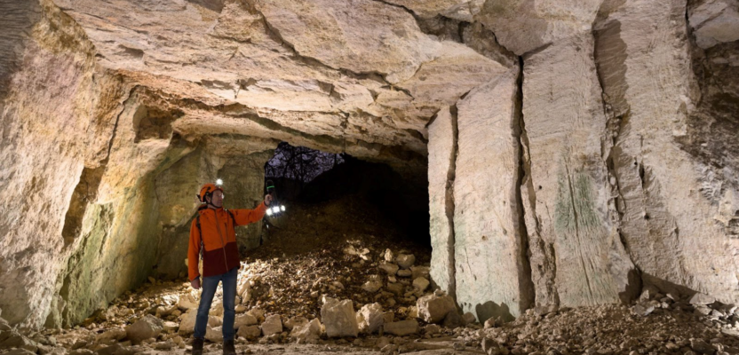
According to the United States Geological Survey, karst areas are “characterized by distinctive landforms (like springs, caves, sinkholes) and a unique hydrogeology that results in aquifers that are highly productive but extremely vulnerable to contamination.” For the karst aquifers studied by CHYN, the project involved detailed mapping of the karst caves’ internal surfaces to understand water flow and contamination, among other factors.
Navigating the journey through kilometers of karst conduits required cutting-edge mobile scanning technology. BLK2GO was chosen as the tool to support the endeavor, offering a valuable solution for this task that required an efficient way to capture the complex geometry accurately. With the BLK2GO, researchers could map large areas quickly and with greater mobility than traditional scanning.
The work by Racine and his team shows a future where technology serves as the medium reaching underground water networks that were either hard to reach or difficult to measure and monitor. These scientists are now learning precisely how these aquifers, conduits, and caves work, which helps researchers and public works officials monitor and create more sustainable uses of water resources.
—Source: Leica Geosystems/Christopher Dollard.