Tragedy, in the form of natural disasters, typically involves the geospatial professions. As an industry we help plan for and react to floods, wildfires, hurricanes, tornadoes and other forms of Mother Nature’s will that wreak havoc on life in a particular place. Although often in a different role, we are called upon when manmade disasters happen.
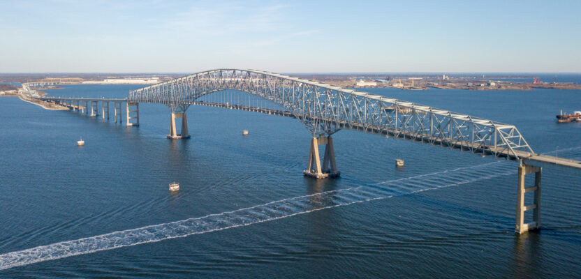
Almost 25 years ago our industry was key to building One World Trade Center, and now we will be a key element in rebuilding the Francis Scott Key Bridge near Baltimore. From land surveyors who will make highly accurate measurements to make sure the new bridge follows a precise route to those who will monitor the remote sensors on the finished superstructure and fly the drones for periodic inspections, geospatialists will play a vital role in Baltimore over the next few years.
Writer Juan B. Plaza takes a look at the intricacies of this lengthy process in his story “Rebuilding in Baltimore” that starts on page 16.
From working on the water to working with water, Marc Delgado looks at how water utility companies are getting “Water from the Cloud.” As water becomes a more precious resource, utilities are using geospatial cloud computing to map their infrastructure, streamline workflows, and enhance their customers’ experience. Does this cloud have a silver lining?
As our shoreline and ocean water becomes more important from a geospatial perspective, it is also becoming important from a security standpoint. Contributor George Gladorisi takes a look at new technologies that will help keep our offshore energy sources safe. And one final article involving water, but more involving laser scanning, contributor Mack Kowalski looks at how acrylic panels in the new Seattle aquarium were precision-fit to give visitors a spectacular view of aquatic life.
I hope you enjoy the issue.