Water utility companies are tapping into geospatial cloud computing to map their infrastructure, streamline workflows, and enhance customer services
Clouds are important to the Earth’s water cycle. By gathering vapor from one region and then dropping it as rain in another, they serve as the main conduits to move water across the Earth’s surface. So, when one of the largest water and wastewater services companies in the U.S. says that it has headed to the cloud, you might be excused for the mix-up.
The cloud that the Great Lakes Water Authority (GLWA) refers to is “cloud computing” or the delivery of digital services, from data storage to software and analytics, over the Internet.
GLWA is using cloud computing not only to help it maintain the potability of the water that it provides to 40 percent of Michigan’s population (roughly 3.8 million people), but also to make it possible to deliver wastewater services to nearly 30 percent of the region. As the largest state east of the Mississippi River, water demand in Michigan is driven mostly by domestic use, industry, fisheries, and agriculture. Managing such a huge area can be difficult, especially when (GLWA) has to regularly inspect the quality of the water bodies.

Data from water quality monitoring goes straight to the cloud.
Before GLWA migrated to the cloud, monitoring teams had to visit and draw test samples from various sites covering some 1,698 square-mile of service area. Then after that, they had to manually input the water quality data into unconnected computer systems. It could take six months to a year to be able to share their reports to their partner communities.
But in 2020, GLWA rolled out AURA, a digital program that their partner communities can use to automate their water quality monitoring activities, which gives them access to water and wastewater maps, all free.
Developed by the company Aquasight, and deployed using the cloud-based Amazon Web Services (AWS), AURA provides a smart water platform which allows all of GLWA’s member communities to view various water quality parameters in real-time using computer dashboards and mobile devices that are linked to the Internet.
“Receiving information faster makes it more actionable and means member partners can respond to potential issues before water quality is impacted,” said Terry Daniel, deputy chief operating officer of water and field services at GLWA. “This has reduced our reporting time from months to the same day and has enabled us to reallocate team members to new work.”
Another feature AURA offers is the possibility to add their own GIS maps and other smart meter data in order to improve their own waterworks asset management plans. There is also plenty of spare space to accommodate more data because AURA utilizes the online scalability of AWS, which adapts to different levels of computing workloads. The system uses Amazon Simple Storage Service (Amazon S3) to store visual assets such as GIS maps, HTML/CSS files, JavaScript resources, and raw data including logs, documents, images, or other unstructured data.
“We can accommodate growing data storage needs without worrying about capacity limitations,” said David Inman, the onboarding manager at Aquasight. “We’re able to build applications on this flexible framework and quickly scale to needed capacity.”
Geospatial Cloud Computing
AURA is just one of the many examples that show how cloud computing is transforming the way geospatial data is collected and analyzed for the benefit of water utilities. Esri, one of the world’s biggest GIS companies, has taken notice of the trend and has now developed its own geospatial cloud strategy, which aims to provide quick integration and analysis of large geo-datasets and imagery from city to regional or even global levels.
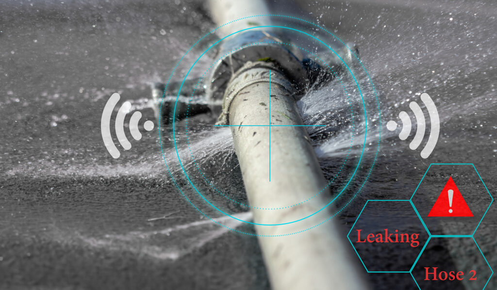
Smart sensors can detect and monitor water leakage direct to the cloud.
For example, Esri has been working with Loudoun Water so that the community-owned water utility company based in Virginia can implement its stand-alone enterprise software and link it with Esri’s own GIS mapping functionalities. While Loudoun Water uses GIS to keep a geodatabase of all its waterworks assets (pipes, maintenance holes, hydrants), it also links all the mapped data with the SAP software in order to harmonize all the maintenance and engineering operations in the field.
In fact, Loudoun Water is one of the first water utility companies to integrate GIS mapping with the SAP asset and maintenance management software. And later on, when the company implemented its cloud-first policy for technology, Loudoun Water was able to migrate all of its geospatial and SAP solutions to Microsoft’s Azure, another cloud service provider.
Their pioneering work has been recognized by Esri as a model for other waterworks providers who are building their own smart mapping solutions. They won Esri’s Special Achievement in GIS award in 2017 and another special GIS award during the previous year.
“I’ve been watching Loudoun County for a long time through the evolution of their technology,” said Jack Dangermond, founder and president of Esri, in a separate interview with Geospatial World. “Loudoun not only continues paving the way in open data but serves as an example for how governments of all sizes can engage the public and become smart communities.”
The success of Loudoun Water in geospatial cloud computing may be partly because it is at the right place at the right time. Loudoun County is located in the cloud capital of the world, where roughly 70 percent of the world’s Internet traffic goes through one of the more than one hundred data centers located there.
“The cloud is based somewhere and, by and large, the cloud has been based here in Loudoun County, Virginia, in the 18 million-square-feet of data centers that we have on the ground here,” said Buddy Rizer, executive director of economic development for Loudoun County, in an interview with VOA. Other cloud computing powerhouses with data centers that operate in the Loudoun area are Amazon and Google.
Enhancing customer engagement
While Loudoun uses cloud computing to monitor its water assets, other water utility companies are tapping the cloud to improve how they engage with their customers.
Take for instance South East Water, a company that supplies 521 million liters of drinking water per day to 2.2 million people in the southeast part of England. Its specially designed digital application called “My Account” allows its customers to directly manage their own accounts online via their smartphones or personal computers. With “My Account,” customers can track their household water use and pay their water bills, while also helping them report water leaks and detect water outages using an interactive online map.

Thanks to cloud-computing, customers can map the location of floods and other water problems in real-time using mobile phones.
All this is made possible by Google Cloud Platform (GCP), the suite of cloud computing services offered by Google’s parent company Alphabet. South East Water chose the cloud platform to create the “My Account” application and support its customer-facing portal.
“We listen to our customers’ feedback to match our services to their expectations. Google Cloud gives us everything we need to build an app that empowers us to act on that feedback quickly and cost-effectively,” said Richard Bannister, business services systems manager at South East Water.
Thousands of customers have signed up since the application’s release in 2021.
“We’ve had hundreds of thousands of transactions going through the “My Account” application, and that can be people getting their balance or making a payment,” said Tanya Sephton, customer services director at South East Water. “For example, 25,000 people have used it just to update their payment details, instead of calling our contact center.”
The application makes South East Water’s services more accessible to its customers. Before migrating to the cloud, it used to take days to receive and validate one customer request. Now it only takes 30 seconds. And with the time gained, customer service agents can focus more on talking to customers who call for assistance.
“We’re always looking for innovative ways to help and support our customers,” said Sephton. “And having established our new development environment on Google Cloud, we can explore new tools for pushing the boundaries of how we interact with them as a utility company.”
Cloud Computing is SaaS-y
Deploying to the cloud all the geospatial needs and capabilities of companies brings about several benefits. First, cloud platforms are engineered to scale whatever computing resources are available. This means that bandwidth, storage, and memory can all be pooled together and their usage can be dynamically adjusted proportionate to user demand.
Such elasticity allows the cloud to use more virtual computing machines and storage when the platform has more traffic. But it can also return to fewer or even a single machine and use little memory when the traffic returns to normal.
Second, geospatial cloud computing makes it possible for users to tap into multiple mapping databases. Vector maps, satellite and aerial imagery, weather data, and digital elevation models, for example, could come from different web repositories. And with the use of cloud-based application programming interfaces (API), users can automate complicated workflows and call various geodatabases as they see fit.
Migrating to geospatial cloud computing makes it possible for users to access geospatial applications via SaaS or Software-as-a-Service platforms. Several GIS applications such as ArcGISOnline, CartoDB, Mapbox, and Rstudio follow the SaaS-model to provide hundreds of on-demand spatial analysis and visualization functions to their customers.
With SaaS, customers hardly need to install anything on their computers or write code on their screens. The service also allows businesses to save up on costs by eliminating the need to purchase mapping software and hardware storage peripherals. Because companies only pay for the IT resources that they use, SaaS has become a more cost-effective alternative to traditional GIS desktop mapping.
Yet despite all these benefits, migrating to the cloud can be daunting to businesses. Many geospatial professionals are hesitant to work in the cloud due to their lack of skills. Also, the high price of cloud services can be expensive for smaller companies. What’s more, concerns about data security remain valid because cloud services are still prone to outages caused by fire, water damage, and cyberattacks.
As a result, global spending last year on cloud computing declined after a decade of growth. As not every cloud has a silver lining, water utility companies should be aware of these issues before they move their geospatial activities to virtual space.