
New geospatial software combines the appeal of games with the rigor of applications.
It’s never been done before: applying the rigor and disciplines of civil engineering, mining engineering, hydrology, and even classic survey field-to-finish to game-like 3D design. Sure, CAD operators have had 3D viewing for years, which they use to review the results of plan view design from oblique angles. But, except for a few, limited procedures like pad design, they have not actually designed in 3D. This is changing.
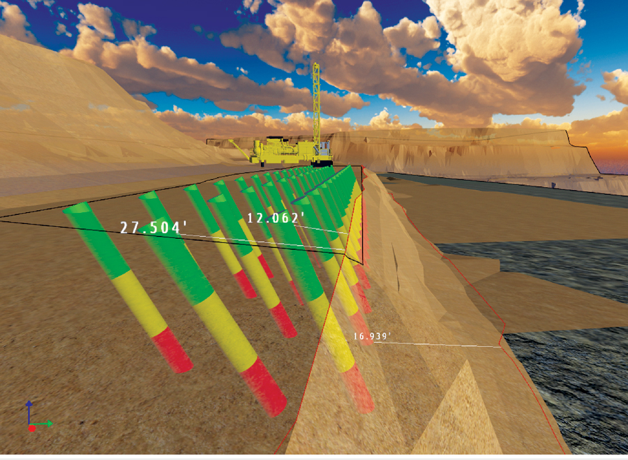
Proposed 3D design software will enable users to create and work with such images as this drill hole layout.
CAD may become merely the final destination of 3D designs, relegated to the same status as print. You will work in 3D, visualize and imagine, test and try things, then save to CAD in your preferred output styles, and finally print the hard copies or PDF deliverables. Design will be a 3D experience accessible to the engineer and designer, not just the CAD expert. And CAD will become merely the output vehicle, focused on annotation, standard details, and certifications.
Games are fun; real work should be fun, too! This is where design has to go (and should have already).
Carlson Software is developing an entire series of applications on a 3D platform that combines intelligent texturing with solid modeling. You can place objects and add shadow effects to create realism. The vast and expanding library of publicly available 3D objects allows you to create realistic designs that not only view in 3D, but also plot correctly to CAD in 2D. Adjust object locations by grip and move, with real-time dimensioning controls. These tools are being applied across the Carlson spectrum of design products.
The very things that make games so attractive apply just as well to engineering design. Take, for example, hydrology. In a storm, water flows, streams rise, ponds fill up. Show the water in motion to indicate direction of flow. When evaluating spillways in ponds or culverts under highways, use the power of 3D to simulate and reveal problems. Draw headwater lines and spillover lines in 3D. Surface water can even come alive with wave action, set to any intensity level.
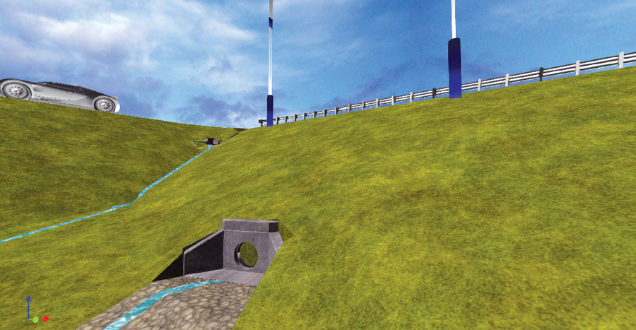
Color, texture, and thickness parameters will be available for working with such projects as this highway culvert analysis and design.
Game-like motion can also reveal the impact of design. Take the headwall shown at the upper right. When placed (selected from a large and expanding library), include the option to push the headwall into the hill with real-time motion right up to a defined “freeboard” above natural ground. This reduces the necessary pipe lengths, which change real-time during this design process. Every headwall selection includes its own set of parameters, such as Ke value for entrance loss coefficient. The ponded water is drained, and water flows through the pipe. Yet the output is ready to export to CAD or even send to a 3D printer for presentation to owners or planning commissions.
Surface transparency is a real benefit when viewing underground pipe systems, or laying out drillholes for blasting, or in reviewing geologic formations. The 3D environment also allows for a variety of “inspection” routines, where you see coordinates and even review offset distances to defined surfaces or objects real-time as you move your cursor or highlight objects.
LandXML2.0 will be released in December by LandXML.org (managed by Carlson) and will include color, texture, and thickness parameters for improved 3D design. Now, not only can surfaces be saved as x,y,z data, but you can also associate color and textures directly with any triangle or grid within the .xml file. In this way, surfaces that are made will show asphalt, concrete, gravel, and grass within Carlson Precision 3D or other programs that use this added feature. The entire design market will be able to share surfaces whereby the extra parameters enhance visualization and add model “intelligence” to the shared surface data. BIM anyone?
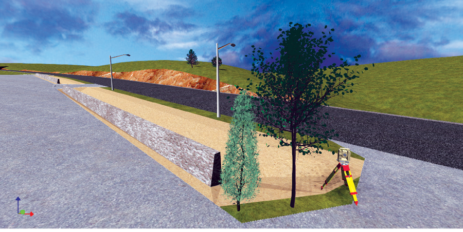
Color, texture, and thickness parameters will be available for working with such projects as this U.S. 68 Kentucky road design, field to finish.
All designs can export by LandXML to any CAD (Autocad, Microstation, Intellicad) and tap the annotation features and styles necessary for pipe system, highway design, and general dimension labeling. And developers take note—this platform is available for third-party use to make your own software applications.
With 3D, design can be fun and rigorous at the same time. True 3D design will reinvigorate the engineering profession and unleash more creative and thoroughly researched designs. Talk about looking forward to coming to work! Let the games begin!