Category Archives: Spatial IT/GIS
Top of the Crop: Best of Pangaea 2015
As we end the year 2015, it’s interesting and informative to look back and see what you, our readers, found most interesting. Using metrics gleaned from our newsletter platform, I picked the top five issues for… Best of Pangaea 2015 Surprising UAS Section 333 Exemptions UAS continue to be a hot topic as the FAA...
Web Mapping
Part 1, The Basics Children of the millennium will never know that there was a time before the internet when we, the cartographers, engineers, and surveyors had to relate geospatial information through the medium of paper. Although the internet has been around since the late 1980s, it wasn’t until 1996 when the world got the...

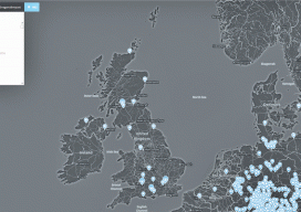
Smart Cities
They’re guided by people and powered by geospatial information. We’ve all heard the buzzword, “smart city.” But what is a smart city, and what makes it smarter than others? One of the key characteristics is the ability to make effective connections—among citizens, assets, and services—by using technology to support and improve the interaction among people...
Industry Profile: Nickson Odieny Onyango
Geospatial Specialist/GIS Developer at Coretec Systems & Solutions Kenya has seen rapid growth in science and technology, health services, land management, development, social action, environmental studies, education, economic empowerment, disaster preparedness, and humanitarian relief. In all of these areas, geospatial sciences have played pivotal roles, and they’re of specific interest, both personally and professionally, to...
Beth Schechter
Curriculum Writer at Skullcrush Sometimes, significant forces for change for the geospatial community come from outside traditional channels. Beth Schechter is an educator, designer, and author with a mission to change the world through writing, data, education … and maps! With a masters in digital media from the Georgia Institute of Technology and a bachelors...
Caitlin Blundell
Director of Geographic Design Caitlin Blundell launched Geographic Design in 2011 after graduating from the University of Toronto with an MA in geography; Geographic Design provides GIS services to clients in the urban design industry. She excels at communicating the value of geospatial data, tools, and technology to people outside our sector. Caitlin is on...