Category Archives: Spatial IT/GIS
Natalie Martinez
U.S. Army Corps of Engineers, Washington DC, USA Natalie Martinez stands out among the multiple nominations for alumni (and students) of the excellent surveying program of the University of Puerto Rico, Mayaguez campus. The surveying and topography degree program covers property surveying and boundary law, topographic surveying and location of infrastructure, surveying to support engineering design and...

Alison DeGraff Ollivierre
Cartographer, National Geographic Maps Colorado, USA With interests in participatory mapping, outdoor recreation and travel cartography, small-island developing states, climate change, spatial planning, and conservation, Aly Ollivierre spreads her work as a cartographer widely and generously. She’s a cartographer at National Geographic Maps, a freelancer doing cartography/GIS work at Tombolo Maps & Design, and a...

Edgar Barreira
GIS Strategist and Natural Resources Account Manager, Esri Portugal As the Portuguese representative of Young Surveyors Network, account manager at Esri Portugal, business consultant, and owner of a small company, Edgar Barreira is a true young entrepreneur. At Esri, Edgar develops GIS strategies for customers’ needs; manages, identifies, and generates sales opportunities and assists in...

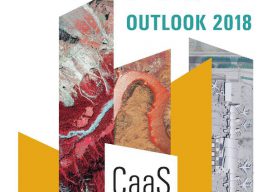
HxIP as CaaS
How a prominent manufacturer of mapping airborne sensors and solutions has partnered with customers to expand its global online content service. At HxGN LIVE 2015, the annual exhibition and conference for Hexagon (parent company of Leica Geosystems), CEO and president Ola Rollén spoke about a new area of focus for the company: content services, or...
Melanie Abuel
GIS Manager, Manila Water Company, Inc. Philippines As the (very young) head of GIS development at Manila Water, Melanie Abuel leads a team that serves 6M people while managing the assets of 6000 km of pipes and 250 facilities. In addition to database and GIS mobile application development, her team works on UAV and lidar...

Managing Canada’s Data
From mapping utility poles to mapping radio frequency signal leaks, this company collects and manages much of the country’s utilities and oil and gas data. Effigis is an interesting Canadian firm that offers a range of GIS solutions for utilities and the oil and gas industry—as well as its own GNSS positioning solution for asset inventory/mapping and utility/energy...