Category Archives: Spatial IT/GIS

Taisha Waeny
Project Manager, Esri, in Australia and New Zealand We received multiple nominations for this dynamic geospatial professional from three continents. Taisha Waeny has become one of the most-recognized voices for the international community of Esri CityEngine users and the broader geospatial community, as well. Taisha encourages young people to enter the geomatics profession by pointing...

Monica Stephens
Assistant Professor, the State University of New York at Buffalo New York, USA Big data, the geoweb, the influence of maps and mapping on society, and volunteered geographical information (VDI) are some of the subjects taught and researched by Dr. Monica Stephens. A popular educator and guest speaker, Monica is also a geo-blogger, tackling map...

Natalie Dobbs
Vice President, Spatial Innovision Ltd. Trinidad and Tobago Natalie Hobbs serves on the Vanguard Cabinet of the Urban and Regional Information Systems Association (URISA), the international nonprofit association of GIS practitioners. The Cabinet, formed in 2011, seeks to engage and support young GIS practitioners and professionals. Internationally recognized and lauded for her work in these...

Minimum and Maximum Z Values in ArcGIS Pro
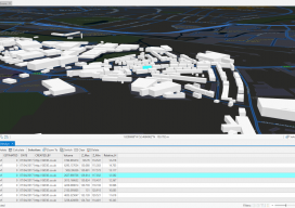
In ArcGIS Pro, why are my minimum and maximum Z values wrong, and how do I fix it? Until recently, this isn’t the kind of question you would expect a GIS user to ask. Of late there have been many innovations in the geospatial software world, and the GIS user is now having to come...

Paul Georgie
Founder and Principal Technologist, Geo.Geo, United Kingdom This geospatial visionary works at the intersection of GIS and smart cities, but Paul Georgie considers himself to be a lifelong geographer. His background is in international development, and at Geo.Geo the main focus is emergency and disaster response. Geo.Geo lowers the barriers of access for governments, organizations, and...

GD3D® Signs Innovative Data Agreement with CyberCity3D™ ahead of ArcGIS Marketplace Launch
(Cumbria, UK) January 23, 2018: GD3D® Signs Innovative Data Agreement with CyberCity3D™ ahead of ArcGIS Marketplace Launch PRESS RELEASE: GD3D®, the geospatial arm of Garsdale Design, is a leading 3D GIS consultancy based in Cumbria, United Kingdom. Today an agreement has been signed with CyberCity 3D Incorporated, a California 3D geospatial content company, to resell premium...
