Category Archives: Spatial IT/GIS

Laser Scanning for GIS and FM
On the surface, rich laser- scan data seems like a natural, valuable addition to GIS and facility management (FM) solutions—and to related operations and maintenance and asset-management capabilities. Much as the emergence of GPS in the 1990s helped drive GIS adoption and growth, the emergence of laser scanning also feels ready to aid GIS, FM,...

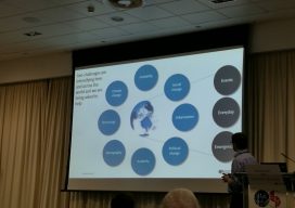
GEO Business 2018: “Geocoolness” in the London Heat
Trends in geomatics tech and spatial IT at the UK’s premier annual geo conference and exhibition Editor’s Note: GEO Business is an annual conference held annually in London. xyHt’s Europe editor, Nick Duggan has been attending each year, chronicling trends in the geo industry. The event is growing into one of the premier geo events...

Easy 3D
A surveyor tests software solutions from an innovative Canadian firm for managing, processing, navigating in, and visualizing large 3D data sets. When do you have enough software? Is it when you’ve finally reached the ability to perform a software program’s base use that drove you to purchase it in the first place? Or is it...

Freeing the Data
A Canadian software company is making it easy for the geospatial community (and beyond) to work with, exchange, and extract value from data. Many GIS professionals—and others in the geospatial community and beyond—use Safe Software’s FME daily to convert, extract, and analyze data. Yet, few of them know much, if anything, about the Canadian company that...

Open Source for Enterprise Solutions
A geospatial firm integrates open-source GIS and cloud services for the DoD’s IT security, a giant energy co-op managing 2,500 miles of transmission lines, and the USACE as they monitor dredging vessels. Too often, clients maintain outdated and inefficient workflows because they fear that building applications to improve processes would be too time-consuming and expensive....
Improving GNSS in the Urban Canyon
To prepare you for the this blog post, I wish to point out that I am a geospatial expert and can hold my own around the ins and outs of survey, so going to an event at the Ordnance Survey on “3D mapping for the improvement of GNSS in urban areas” was an eye-opener. You...