Category Archives: Spatial IT/GIS
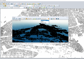
Global Mapper Review
Although I’ve been using GIS for more years than I can remember, until xyHt took me out to InterGeo I had never heard of Global Mapper. I thought I’d used every GIS there was; I’ve even used some that only a select few have ever heard of (StruMap anyone?). The market is saturated with GIS, and...
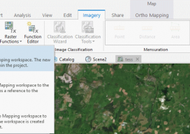
Using Ortho Imagery (Digital Aerial) in ArcGIS Pro
The new version of Esri’s ArcGIS Pro software offers the capability to use stereo imagery, something of great use to those looking to digitize and use 3D vector data. To this end, I thought I would try bringing in some stereo aerial data to see how the process works within ArcGIS Pro. Vague Knowledge At...

The Gamification of the Geospatial Industry
Why Is It Important? With huge, sprawling maps and realistic cities now appearing in our video games, it begs the question as to how these amazing cities render so quickly, yet we geospatial experts still sit waiting for 10 minutes for our software to open. For example, the notorious Grand Theft Auto: San Andreas (pictured...

Epson Abides – New Wide Format Plotters for the Small Office
A New Series of Large-format Plotters for Small Businesses and Home Offices At the 2018 Esri User Conference and Exhibition, Epson announced a new line of T-Series large-format plotters that should appeal to small home/office needs for surveyors, engineers, architects, designers, and people working in schools and construction job shacks. Folks can plot out check...

Where the Data Comes From
Members of Esri’s Living Atlas unit detail the company’s wide variety of data sources. For nearly 50 years, Esri has been developing and supporting GIS software. What is less known is that for more than 20 years it has also been collecting and curating data and making it available to its users. “It has become...

An Interview with Charles Kennelly – CTO Esri UK
Charles Kennelly became CTO of Esri UK in 2008, and, unlike many people in similar positions, he takes time to listen to “the little man.” I fondly remember giving a talk at FOSS4G UK a few years back and seeing Charles there front and center in the audience. After I finished he immediately told me...