Category Archives: Spatial IT/GIS

Interview with Esri’s Eric Wittner
Eric Wittner is the CityEngine and Procedural Technology product manager at Esri. He works to expand public understanding of how Esri’s 3D products can enhance an organization’s products and process and help bring them success. Nick Duggan: What exactly is CityEngine? Eric Wittner: CityEngine has been with us for a while. They started as an...

Interview with Esri’s Jeremy Wright
At first glance, Jeremy Wright may not seem important: he’s just a product engineer for the world’s largest and most popular GIS. But when I was meeting and interviewing people in San Diego at the Esri UC for xyHt, I made a point of searching for Jeremy. He’s passionate about his work and heavily involved in...
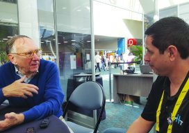
An Interview with Jack Dangermond
When I was invited by xyHt to attend the 2018 Esri User Conference, there was only one requirement: I had to interview Jack Dangermond, co-founder (with Laura Dangermond, his wife) of Esri. I was given a 15-minute interview slot on a Wednesday morning, which I hoped would be long enough to get a few big...

AI-enabled UAS Inspection
AI provides UAS users with biased analytics, the ability to analyze data for insights, and the knowledge of when to act. Artificial intelligence (AI) is at the center of controversies regarding jobs and employment. Will AI take away all our jobs? While some jobs will indeed change or disappear as they have always and will...
Time & Progress
Editor’s note: As an example of how far QGIS has evolved and the depth of the many features and plugins, Anita Graser, key member of the QGIS team and author of popular QGIS guide books, offers the following details. Graser was also one of xyHt’s 2015 inaugural 40 geospatial professionals under 40. More and...
QGIS Chair
An Interview with Paolo Cavallini Paolo Cavallini has been part of QGIS for as long as I can remember. Whenever I’ve had problems or made a remark on the QGIS mailing list, he has been there to help. He is everything you don’t expect a developer to be. Furthermore, he has now become chair of...