Category Archives: Spatial IT/GIS

New Gold Standard for GPS
GPS users help map habitat along the Bear River for the Bear River Land Conservancy in Utah on June 7, 2017. Credit: Kirk Earl. As accurate GNSS data becomes democratized, there’s still a place to stand out in the industry. The long-established GPS industry has been facing a massive technological disruption for the past five...
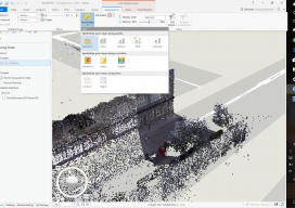
What Is Esri?
Over the last few years we (at xyHt) have discussed Esri as an industry-leading GIS many times, but what is it? What is ArcMap, ArcGIS Pro, or any of the other things with “Arc” names? The truth is a little confusing, but at the same time a little clever. In this blog I hope to demystify...
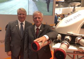
Seen at Intergeo
xyHt staff were out in force at the world’s largest geospatial conference in Frankfurt in October, and here’s what we saw of special interest. Riegl’s Big 4-0 Riegl celebrated its 40th anniversary at Intergeo. Pictured here are Jim Van Rens and Dr. Riegl, the company’s founder. New Vector Extraction in 3D Extraction of useful information...
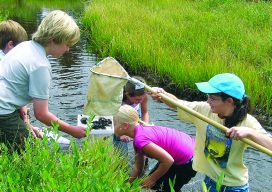
GIS in K-12
Above: Middle school students collect macroinvertebrates in Rocky Mountain National Park. The data will be mapped and analyzed using a GIS. Credit: Joseph Kerski. Where did you first learn about GIS? Was it in a course at a university or a community college? Were you an undergraduate or graduate student? Was it at a conference,...

Interview with Esri’s Ben Flanagan
Ever wonder who makes those maps you see in the newspaper? Ben has made maps for the Telegraph, the Guardian, and BBC News, and best of all (to me) he’s from the UK! Ben is like a ninja—not many people know about him but those that do are avid fans of his work. It was...
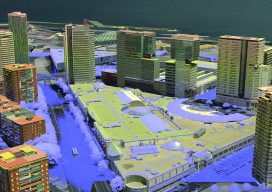
3D Cities from a Single System
Above: This screenshot is of CityMapper output. A look at the hybrid airborne system that combines lidar with oblique and nadir imagery. Over the last five years I’ve built and used a lot of 3D GIS and BIM models. Almost all of this has required the capture of stereo imagery and oblique imagery and a...