Category Archives: Magazine

xyHt Magazine January 2018 Issue
Click on the cover below to view the January 2018 issue of xyHt magazine. Articles in the issue include (links will turn live throughout January): Infrastructure, BIM, and the Brothers Bentley: Meeting the needs of the global infrastructure boom, Bentley Systems has forged technology partnerships; moved to erase the workflow barriers among surveying, engineering, and construction; and...

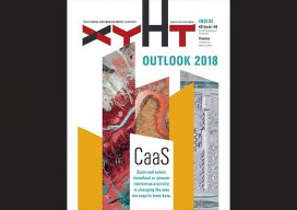
xyHt Magazine Outlook 2018 Supplement
Click on the cover below to view the PDF version of Outlook 2018 supplement to xyHt Magazine. Articles in this issue include (links will go live throughout January): HxIP: How a prominent manufacturer of mapping airborne sensors and solutions has partnered with customers to expand its global online content service. “No Job Is Too Big...

xyHt Magazine December 2017 Issue
Click on the cover below to view the December 2017 issue of xyHt magazine. Articles from this issue include: (They appear as links as they go live throughout the month.) 2022 and You (The issue’s editorial) 2022: Monumental Changes, Part 1 The Geodude on the Value of 360° Digital Panoramic Images Maps as Art: The...

xyHt Magazine November 2017 Issue
Click on the cover below to view the November 2017 issue of xyHt magazine. Articles from this issue include (they appear as links as they go live throughout the month): BLK360 + ReCap Pro Protecting Your Eyesight Store-bought or Homegrown? Mentors for the Future Building a Solid Case: Forensic mapping with laser scanning Recovering...

xyHt Magazine October 2017 Issue
To view the October 2017 issue as it appears in full in print, click the cover: Articles from this issue include: Organic Integration of UAS: A mapping and design firm in the Pacific Northwest implements UAS in diverse urban and rural environments. Unmanned Lidar in the Air: A discourse on UAV lidar from the perspectives...

xyHt Magazine September 2017 Issue
To view this issue as it appears in full in print, click the cover: Articles from this issue include: Go for the Beer! Recording, Registration, and Cadastres: Comparing systems for real-property management in the Netherlands and the United States. GPR Revisited: Arrays of multiple sensors and advances in processing breathe new life into the field...
