Category Archives: Lidar/Imaging

How to Talk with Clients About Laser Scanning
Clients should choose a laser scan primarily when they need to document existing conditions for a future construction or complex renovation project. When complex conditions exist, the risk of a mistake using a tape measure and sketch pad greatly increases the probability of a construction error. If this matches our clients’ needs, we then discuss...

Accuracy With Small UAS Mapping
Two recent advances in heretofore unrelated technologies are giving birth to a new way to perform local-area metric mapping. The first is the development of small, unmanned aerial systems (sUAS), spurred on primarily by the miniaturization of autopilot components. The second is the development of novel algorithms for creating digital surface models from collections of...

From Traditional Photogrammetry to UAS
Photogrammetry has changed substantially in the past three decades. When Jeff Yates began in the business 32 years ago, he used a projection system known as a Kelsh two-bucket plotter. “That was four generations ago of photogrammetric systems hardware,” he recalls. “From there, we went to the analog stereo plotter. That was the second big...

We Can Do This
“It was not a matter of ‘if’ we could do this project,” said Brian Mayfield, Atlantic’s president and chief operating officer. “It was a matter of how. Then there was the question of ‘Exactly how remote is Nunavut?’ What are the conditions, and what resources would be available?” The proposed project site, in an uninhabited...
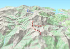
Create an Awesome 3D Map in Minutes in #QGIS
Until recently, 3D has been a bit of a gimmick to the everyday GIS user, by this I mean that it has been quite time consuming to create a GOOD 3D representation (easily) until now. I’ve used some great 3D software whilst working on survey data and also visualisation of environmental impacts, Fledermaus, ArcScene, Sketchup,...

Autodesk and Measurement
“After all of these years, I’m really happy to be able to say that Autodesk is now truly in the measurement business,” says Pete Kelsey, Autodesk’s strategic projects executive. Though he was quick to add qualifiers to that statement: “We are not in the measurement hardware business, but we are now more closely aligned with...