Category Archives: Lidar/Imaging

Exceeding the Limits
Forensic survey technology is now a need rather than a luxury as Latin America’s urban concentration accelerates. For decades the art and science of determining how a crime was commit-ted and how a car crash occurred has relied on expert hypotheses based on personal experience and memory. Experts have used tape measures, cameras, and paper...
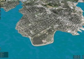
CLIVE: Communicating Risk in 3D
Above: The current sea level and coastline of the city of Charlottetown on Prince Edward Island, Canada. Static 3D models of topography and buildings are commonplace in both technical and popular geospatial software. There are still very few 3D tools, however, that enable users to geo-visualize dynamic phenomena, such as the effects of climate...
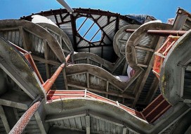
Choosing the Right Data Capture Tool for BIM
Above: This 3D image shows vertical measurements of the CUNY Applied Science Research Campus, where Bradford performed a 3D as-built measurement of all the recently constructed slab edges across six floors of the two new buildings. With the rise in demand for fast and accurate 3D construction information, laser scanning has become invaluable to many...
The New Spacescape
Small satellites are changing who dominates the field of satellite remote sensing. Move over military and government policy and regulation. Make way for private companies and even the public. There are big changes afoot in the satellite remote-sensing field: improved technology as well as regulatory shifts enabling the application of this technology (see “New Markets for Satellite...

Mobile, Indoor Sensing Devices
Above: 3D sensing mobile devices can create maps of indoor spaces, as demonstrated by this simulated image from Occipital. Credit: Occipital. Mobile 3D sensing devices are big news right now. The announcement of one by Google’s Advanced Technology and Projects (ATAP) group made a stir on social media and the tech blogs back in February...

Capturing the Bluestone Dam
Above: Bluestone Dam is a concrete gravity dam located just upstream of the confluence of the New and Greenbrier Rivers near Hinton, West Virginia. Editor’s note: Because the Bluestone Dam is critical infrastructure, the Corps cannot display images of its insides. In fact, security is one of the key reasons it didn’t contract out the...