Category Archives: Lidar/Imaging
True 3D Design
New geospatial software combines the appeal of games with the rigor of applications. It’s never been done before: applying the rigor and disciplines of civil engineering, mining engineering, hydrology, and even classic survey field-to-finish to game-like 3D design. Sure, CAD operators have had 3D viewing for years, which they use to review the results of...
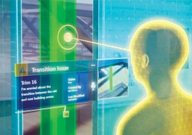
Blending Realities
A 3D design and visualization tool with phenomenal potential in the AEC world is coming from a collaboration between Microsoft and Trimble. Imagine designing an object, in 3D and color, using only gaze, gestures, and voice (GGV) commands. Imagine designing an entire building the same way—or modifying an existing one. Imagine moving in a physical...

Optical Monitoring
Above: Imetrum’s portable, long-range, camera-based monitoring system was used in the benchmarking trial. How reliable are optical monitoring techniques for civil engineering structures? Editor’s Note: Camera-based systems have long been used in industrial metrology for manufacturing, materials testing, and integrity monitoring. Now they’re finding utility in the “macro” realms of AEC (architecture, engineering, and construction). Many people in the...
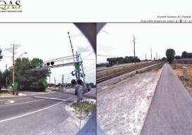
Signs of Change
Above: This image, created with Woolpert’s online QC tool eQAS, illustrates the ability to review sign data from multiple perspectives and provides lidar and image data at the location of each sign. One collect, multiple uses. A mobile mapping system (MMS) is a versatile tool capable of creating both GIS asset inventories and design-level mapping...

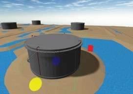
Stockpile Reports
How to do enterprise inventory management from image-based 3D reconstruction, in the cloud and in your pocket. “No one wakes up in the morning thinking that they need to buy a point cloud,” says URC Ventures CEO David Boardman. “Most people would be thinking that they need to solve some business problem.” What URC Ventures...
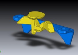
3D Printing Forrealz
Imagine purchasing a new washer and dryer. Inside is a little package with the usual owner’s manual and warranty information, but also … a little usb drive. Imagine receiving a similar usb drive when you purchase a new car. And another when you buy a piece of furniture. You file them away thinking they might...