Category Archives: Lidar/Imaging

Smart Access for 3D Cities
Above: A view from the OpenCities Planner online 3D city model web portal (hosted by Agency9) for Gothenburg, Sweden. A new skyscraper (now under construction) was added to provide planners and citizens a realistic idea of the visual impact of the proposed development. Credit for all images in this article: Bentley Systems. Today’s 3D city...

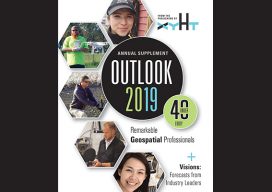
Rebecca Aguilar
Support Specialist, Topcon Positioning Systems California, USA Even the savviest users of the increasingly powerful geomatics/geospatial hardware and software sometimes need a helping hand. With great power can come great conundrums that, without excellent support resources, can be difficult to solve—especially with deadlines and spiraling costs on the line. Rebecca Aguilar has already proven to...

Justin Barton
Product Manager, Laser Scanning Systems, Leica Geosystems California, USA An early adopter and long-time practitioner of laser scanning, Justin Barton comes from an archeology background and spent nearly a decade with the world-renowned team of CyArk, a non-profit that creates digital records of sites and works of historic significance. Barton studied anthropology at UC Berkeley,...

Yan Fu, PhD
Principal Research Engineer, Autodesk – California, USA 3D, 3D modeling, 3D reality capture, 3D smart cities—these seem to be the zeitgeist of the present world of AEC and are touted as the path forward that will reap great benefits in engineering efficiencies. Managing and using enormous spatial datasets is a challenge, as anyone who has...
Surveyors as Movie Makers
Above: Each virtual camera position needs to be properly oriented for what you want the viewer to see. Credit: Rodrigo Garcia. Opposite: The movie maker places several virtual camera positions to form a path for a fly-through effect on scan-based movies. Credit: Leica Geosystems. In my last Geodude article, I drew an analogy between surveyors...

Geomatics at UAA
Above: Matt Santiago, current UAA geomatics student, is perfecting his surveying technique in the “classroom,” i.e. the South Fork of Chester Creek on UAA’s campus. The University of Alaska, Anchorage’s Geomatics Department continues to grow and place all its students in jobs at graduation. Matt Santiago arrived in Alaska wearing Air Force blue. When he...
