Category Archives: Lidar/Imaging

Preventing Damage to Underground Utility Lines
Common Ground Alliance (CGA), the national nonprofit trade association dedicated to protecting underground utility lines, people who dig near them and their communities, today published a Report to the Industry as part of its Next Practices Initiative. The Next Practices Initiative launched in 2020 with the goal of driving innovative solutions to the damage prevention industry’s biggest challenges,...

The Challenges of Near-shore Hydrographic Surveys
Near-shore hydrographic surveying can be a challenging task, especially if the conditions are not ideal to collect the required data.

Digitizing America’s Coast
Legislation passed by congress and signed by the president codifies NOAA’s exemplary digital coast program Geospatial professionals and coastal communities are celebrating the passage of the Digital Coast Act (DCA) by remembering the coordinated efforts from the numerous public and private stakeholders that were necessary to help pass this important legislation. The intent of this...
The Early Days of 3D Scanning: Part 8
In multiple ways, 1999 turned out to be a pivotal year for Cyra Technologies and for 3D laser scanning, in general.

senseFly Expands its Line of Fixed-Wing Mapping Drones
A mapping drone in the $10,000 price range might sound like one of those things that’s too good to be true. And up until now, maybe it was. A Swiss company called senseFly, a global leader in fixed-wing mapping drones, has expanded its flagship eBee X drone solution with the launch of eBee Geo. The...
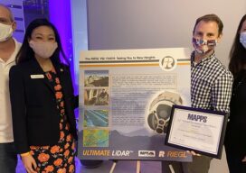
MAPPS 2020 Geospatial Excellence Awards
MAPPS honored members with the 2020 Geospatial Excellence Awards as part of the organization’s 14th annual Awards Presentation that took place January 26, 2021. The event was hosted by Riegl USA in conjunction with the 2021 winter meeting in Orlando, Florida. The Geospatial Excellence Awards are presented to regular and associate member firms whose entries...