Category Archives: Hydro/Marine

Capturing More with Shallow-water Multibeam
Interferometric sonars are providing a new tool for the hydrographic surveyor in shallow to medium-depth water applications. As we begin to return to normalcy after the deepest recession of most of our lifetimes, many ports, coastal authorities, and inland waterways are starting to look at infrastructure projects that have been kept on hold, and they...

Mapping the Scottish Seabed
Six companies collaborate on a project to bury fiber optic cables under the Scottish seabed, stitching segments using hydrography, bathymetry, and surveying. On land, surveyors face challenges due to rough terrain, human activity, weather, and more. Usually, however, the ground beneath their tripods doesn’t move, they can physically occupy positions, and the air between them...

Robot Revolution
Clearpath Robotics CEO Matt Rendall discusses unmanned systems, land survey, and robotic industry trends. The robot revolution is hitting a big milestone. Robotic use is expanding beyond research activities, aerial applications, and industrial manipulators through a new kind of deployment: the service robot. These robots are autonomous, they’re geospatially aware, and they can manipulate...

Finding Fish Hotspots
Marine scientists bring multiple technologies together to locate reef fish aggregations, working towards healthy reefs and island economies. The livelihoods of tropical island communities depend on the vitality of reef fishes, either directly through recreational and commercial fishing or indirectly through healthy coral reef ecosystems that support eco-tourism. Yet, over the last several decades, the...

Hydrography
Above: Corporate social responsibility helps to ensure safety of the environment at a complex interactive drilling operation. Timely Delivery of Data and Products, Marine Spatial Planning, Increased Trusted Partner Resources Here’s a frameworkfor hydrography’s future. Start with the vision of a survey fleet, assisted by unmanned platforms, permanent seafloor installations, remote sensing, and trusted partner...
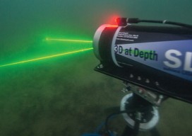
Mapping the USS Arizona
A unique pro bono collaboration creates the first-ever integration of multiple technologies for mapping a historic monument. The battleship USS Arizona was bombed during the Japanese attack on Pearl Harbor on December 7, 1941. The ship exploded and sank, killing 1,177 officers and crew. It now lies at the bottom of the harbor. In 1961, Elvis Presley...