Category Archives: Aerial/UAS

Mapping Alaska with IFSAR
A group of companies overcomes Alaska’s many mapping problems using coordinated teamwork and IFSAR. In 2008, Alaska had never been mapped at any scale to National Map Accuracy Standards, and it was the only state with no statewide orthophotos. Dewberry (a national geospatial company headquartered in Virginia) had written the National Height Modernization Study: Report...

New (and Proposed) Rules for Drones
The FAA has imposed a significant new rule on drone identification and has proposed two new rules that could, when enacted, change the UAS operations landscape. New UAS Marking Rules While UAS identification rules have been the law of the land for some time, last month these rules have been revised. Drones weighing more than...
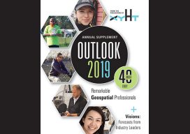
Christopher F. Jordan, PLS
Project Surveyor & UAS Pilot, McGill Associates, P.A. & Geomatics Adjunct Instructor, Asheville-Buncombe Technical Community College North Carolina, USA Chris Jordan is a pioneer in drone technology and has honed his skills over the past decade to catapult his company to being a leader in the surveying industry in his area. Jordan is licensed in...

Why I Heart My Geospatial Job
Above: Marc wears a poncho given to him by his students in Paraguay. xyHt celebrates Valentine’s Day by sharing the love our contributors feel about their geospatial careers. Marc Delgado Loves His Students’ Reactions I love to see and hear my students’ initial reactions when they draw their first map from memory. I’m now in...

Geo Week 2019: Lots and Lots of Lidar
Every time I go to this conference I get the sensation of drinking from a fire hose: so much lidar technology! This year the International LiDAR Mapping Forum (ILMF) became Geo Week with the addition of the ASPRS annual conference and MAPPS winter conference. Here’s a small sample of the wide array of lidar tech...

Standalone UAV Lidar
Above: The YellowScan Vx-20 collected this image in Hiroshima, Japan in May 2018. A surveying company developed a self-contained UAV lidar system so teams could gather data without a lidar specialist. Some companies are born (and some are transformed) when their founders switch their focus from using a tool for projects to developing that tool...