Category Archives: Aerial/UAS

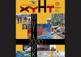
Outlook 2020’s 40 Under 40
The following is xyHt’s 2020 collection of 40 under 40: profiles of motivated and accomplished young professionals under 40 years of age. Click on each name to view their profiles below. Kwabena Obeng Asiam Researcher & Lecturer – Leibniz University Published PhD candidate in land administration; FIG Young Surveyors Ghana Evaluating the evidence and making...

The Best of Commercial UAV Expo
Once again I traveled to that desert paradise we call Las Vegas to attend the Commercial UAV Expo. And once again I was invited to participate in the “Pitch the Press” event. A panel of five “high profile press representatives,” including me, listened to pitches from 15 innovative UAS firms touting the newest offerings. So...

Drone Laws in Kenya
What to Expect in 2020 Drone enthusiasts in Kenya have been treated to a tumultuous love affair by the government. The affair started way back in 2015 when the craze for drones in various parts of the world caught on with a section of the Kenyan population. They started importing drones for commercial activities such...

Mandatory Drone Registration for the UK Looms
Operator ID Is Coming to the UK (Above is the mdMapper3000DµoG from Microdrones.) In the UK, starting November 30th, it will be mandatory for all drone owners [and model aircraft owners of drones/planes weighing more than 250g (8.8oz) up to 20kg (44lbs)] to register their details with the CAA (this is called an OperatorID). Owners of...

A Dam Good Mix
Above: A view of the Brighton Dam in Brookeville, Maryland, from one of the project’s UAVs. Combining UAVs and 3D computer vision can make infrastructure inspections cost-effective. More than 70% of the 90,000 dams scattered across the U.S. are, according to the American Society of Civil Engineers (ASCE), half a century old. The age of dams,...

Esri Partners with 3DR to Launch the ArcGIS Drone Collection
New Partnership Offers Users Best-in-Class Drone Data Capture and Analytics Solution on the Market Esri, the global leader in location intelligence, today announced that it has partnered with 3DR, a leading US drone data company, to expand Esri’s current drone imagery offering, Drone2Map for ArcGIS, with an end-to-end enterprise drone data and analytics solution for Esri’s...
