Category Archives: Aerial/UAS

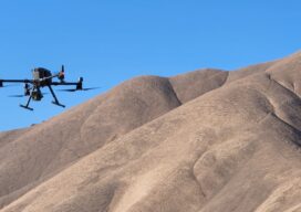
Part 108 Where Are You?
What impact will allowing flights beyond the visual range of the operator have on the mapping industry?
Meteoric Rise of Drone Photogrammetry in Emerging Markets
Meteoric Rise of Drone Photogrammetry in Emerging Markets
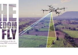
The Freedom to Fly
The Freedom to Fly: The real-time evolution of the direct georeferencing UAV ecosystem

Drone Operators vs. Land Surveyors
Drone Operators vs. Land Surveyors. Are we headed for a confrontation?

It’s a Small (Sensor) World
The fascinating emerging world of geophysical and geological exploration with drones For the last 10 years we have seen more and more applications adopting uncrewed aircraft or drones and adding them to their workflows to expand businesses and offer more versatility to their customers. But like in every other new technology, adoption is not uniform,...
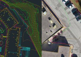
Drone Processing Services: The Importance of Keeping the Human in the Loop
Using a drone processing service can make firms, large and small, more competitive. AI is working wonders for specific steps, but can’t do it all. Vendors and users are finding out how imprtant the human elements is. Drone-based aerial mapping and surveying has evolved, over this first decade of adoption, to include a significant amount...