
Blog

xyHt Weekly News Recap: 05/10/2024
Teledyne FLIR Defense Unveils Rogue 1 Loitering Munition System at SOF Week API Allows Customers to Directly Task World’s Largest SAR Satellite Constellation Registration Open for Commercial UAV Expo Airbus completes acquisition of UAS maker Aerovel Descartes Labs Accelerates Mission-Ready Solutions with EarthDaily Constellation Flight Chaos in NATO Countries Amid GPS Jamming Shift5 introduces GPS...

Topobathymetric Lidar Tackles Great Lakes Coastal Mapping Project
The Great Lakes Restoration Initiative is an effort to protect and restore the largest system of fresh surface water in the world—the Great Lakes. As a part of this initiative, the National Oceanic and Atmospheric Administration (NOAA) has an ongoing effort to update all its bathymetric maps in the Great Lakes region, including advanced maps...
Pioneering for Tomorrow
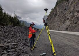
The role of laser scanning in shaping our resiliency to natural hazards

Saving Alcatraz (Digitally)
The infamous island is under attack by climate change, rising sea levels, and old age. Can scanning it from the sky and on the ground preserve it? When the first functional photogrammetry uncrewed aviation vehicles (UAVs) became mainstream technology around 2013, geodesists and land surveyors around the world adopted these flying wonders as an innovative...

Heights 2024
Click on the cover to view the Heights 2024 supplement to xyHt magazine. Articles in the issue include: Moving into the Future: A small Texas photogrammetry company adopted UAVs and is now taking its business to new heights. Modular Drone Sensor Payloads: The goal was flexibility. How Balko Technologies developed a truly modular solution that can evolve with the technologies and help...

Alcatraz from Above and Below
Looking Forward When xyHt author Juan B. Plaza phoned me and said he had access to information and data generated from a recent geospatial project on Alcatraz Island and that he wanted to provide the magazine with a story, I thought, well, that’s pretty cool. In our February issue this year I had written a...
Advertisement