
Blog
Feature: Long Shot
An experienced tunnel surveyor takes on New York City’s East Side Access, the country’s biggest and most complex tunnel project. All photos © Metropolitan Transportation Authority/Patrick CashinControl surveys for long tunnels may be the most nerve-wracking job in surveying; tunnel surveyors must work from short baselines and extend control for miles, with no ties to surface...
Feature: A New Datum
Finally: the rationale for a new geometric geodetic reference frame to replace the North American Datum of 1983. In 2008, the NGS released the publication of a ten-year operating plan that, among other things, called for efforts to replace NAD 83 and NAVD 88, the official horizontal and vertical geodetic datums of the United States. (Note...
Editor’s Desk: Use H, Not Z
During recent correspondence with a surveyor friend who was concerned about a positional difference he had observed at an old triangulation station, he sent me the following information: N = 213674.3282 m, E = 178633.4978 m, Z = 6.989 m. Where the station is located is irrelevant. This type of a coordinate description is...

xyHt News Links: 3/27/15
Numerex Launches SmartGuide, a Satellite-Based Global Tracking Solution George Southard Elected to MAPPS Board Topcon acquires Digi-Star, a global leader in precision agriculture EngineerSupply Expands Product Offerings GISCI Announces Information Sharing Memorandum with USGIF Global Mapper SDK v16.1 Released with Faster Display of Online Data Sources Optech showcasing latest coastal mapping technology at Coastal GeoTools 2015...
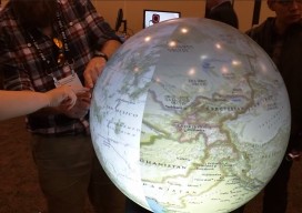
Esri Developer Summit 2015 Highlights
The 2015 Esri Developer Summit (colloquially referred to as the “DevSummit”) was held in Palm Springs, CA, March 10-13. Two thousand+ programmers and technologists participated, seeing the latest developments for building applications in ArcGIS web, desktop and native coding environments. I particularly enjoy the DevSummit events, since they are entirely geekfest in nature, as opposed...
Feature: Delivering Intelligence, Not Data
Technology is making geospatial information real-time and relevant. As powerful, easy-to-use applications and up-to-date location data become available, businesses and consumers are significantly increasing their use of geospatial information. Today’s smartphones and mobile tablets easily access online maps, obtain directions to specific addresses, assess traffic patterns en route, and allow users to plan for the...
Advertisement