Blog

How to Add Transparent Text to ArcGIS in 4 Easy Steps
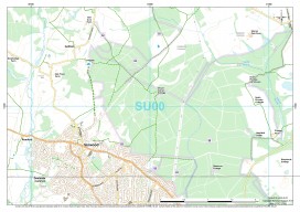
ArcGIS is a great piece of software but has some small functionality missing which, to a cartographer or perfectionist (like myself), can be a little frustrating. So I was really pleased when I discovered a way to create transparent text, something which has eluded me for a long time in ArcGIS. Lets consider this map:...

xyHt May 2015
Click here to view the May 2015 issue of xyHt

xyHt News Links: 05/01/15
Visitor Registrations Flood In for GEO Business 2015 Topcon announces exemption to operate Unmanned Aerial System Phase One Industrial Releases iX Capture 2.0 Software for Aerial Photography Blue Marble Presents Global Mapper’s UAV Tools at the 2015 Unmanned Systems Conference CHC Released the New GNSS Handheld Receiver Exelis Launches Surveillance Tool for UAV Operators NovAtel...

EagleView
The practical side of on-demand aerial image analytics, with an interview of CEO and president Chris Barrow. A contractor showed up at my house to give an estimate for a long overdue roof replacement. He hadn’t pulled out a ladder, so I asked if he needed mine. His response was, “Since we started using EagleView,...

The Right Right
Igor Kidinsky thought about another career for a fleeting moment. His cold fingers struggled to fine-tune the total station. As an Afghanistan war veteran, he sometimes dreamt of spending his life closer to a beach rather than continue freezing in the mountains. He would leave his crew-name of Eager (the Kid) behind and put his...

xyHt News Links: 4/24/15
Autodesk 3ds Max 2016 New LASliberator “frees” LiDAR from Closed Format Teledyne Oceanscience demonstrates New Multibeam Z-Boat at US Hydro 2015 Topcon announces MAGNET v3.0 with increased interconnected functionality Topcon announces new total station with enhanced reflectorless range Go from UAS Imagery to Valuable 3D Information with the New Summit UAS OneButton Bundle Applanix Unveils Expanded...

