
Blog

Comparing Maps a New Way
Above: The new standards are independent of map scale or contour interval and provide a way to deal with lidar data. ASPRS releases new positional accuracy standards. The positional accuracy of geospatial technologies has improved dramatically in the past few decades, and digital maps have replaced paper maps, making old ways of comparing maps obsolete. Satellite...
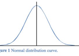
The Normal Distribution, Part 1
Errors in observations can be classified as systematic or random. Systematic errors are errors that follow physical laws and can be mathematically corrected or removed by following proper field procedures with instruments. For example, the expansion or contraction of a steel tape caused by temperatures that differ from the tape’s standard temperature is a systematic...

Creating Energy From Images
Geospatial information has long played an essential role in the energy industry, but now a new technology is cutting costs while improving the flow of knowledge. Editor’s note: The energy sector, oil and gas in particular, has grown more rapidly in the past half dozen years than in the past half a century. New fields,...

xyHt’s 40 Geospatial Leaders under 40
Join xyHt in Celebrating Young Leadership in Geospatial Professions, Industries, and Sciences! Who are the current young geo-leaders internationally? And where are they making a difference? There is a maxim: “We teach children their future, and not our past.” With the exception (in the geospatial realm) of archaeology, forensics, monitoring, and boundary survey (where historical...

xyHt News Links: 6/12/15
USGIF Hosts First GEOINT Hackathon June 12-14 Leica LIDAR Survey Studio 2.2 Provides Color-coded Point Clouds for Advanced Post-processing Teledyne Optech and Orbit GT enter partnership for Mobile Mapping software Topcon announces acquisition of NORAC Sprout by HP Enables Full 3D Scanning with New Capture Application and Accessory

Robot Revolution
Clearpath Robotics CEO Matt Rendall discusses unmanned systems, land survey, and robotic industry trends. The robot revolution is hitting a big milestone. Robotic use is expanding beyond research activities, aerial applications, and industrial manipulators through a new kind of deployment: the service robot. These robots are autonomous, they’re geospatially aware, and they can manipulate...
Advertisement