
Blog

Sampling Statistics
The Chi-squared Distribution In my most recent article (August 2015), I discuss Student’s t distribution and how its properties can be used to isolate blunders in observations. Another sampling distribution that is commonly used in least squares adjustments is the χ2 (chi-squared) distribution. It appears in the form of what is typically called the “goodness of fit”...

Hydro Insights, Part 2
Reviving Interest in the Seas Pictured: The adventures of Jacques Cousteau, his research vessel the Calypso, and his soucoupe plongeante (diving saucer, aka “Denise”) that he co-designed in 1959 captured the imaginations of generations. Editor’s Note: xyHt is honored to feature insights from these two distinguished scientists in the fields of hydrography, marine surveying, and...

xyHt News Links: 11/13/15
EngineerSupply Ranks in the Top 300 of B2B Maps go 3D thanks to machine vision Lockheed Martin Advances Threat Protection on GPS Control Segment Spirent Issues Ebook on Testing Drones, UAVs Ebook: An Introduction to Testing Navigation and Positioning Performance in Drones, UAS and UAVs. Vricon introduces groundbreaking medium-resolution digital surface model The Geological Society...

RTCM
Real-time correction messages: Why this is important and where it’s going Most professional users of GNSS equipment are familiar with the term RTCM. You likely understand that RTCM is a language that is used for delivering real-time corrections to rovers. But that’s usually where the understanding of RTCM stops. This article outlines what RTCM is,...
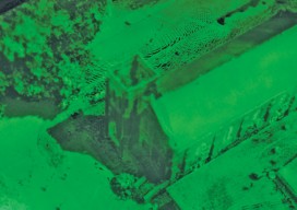
Wizardly 3D
Above: This hologram of a church in Texas was built from a combination of airborne and terrestrial lidar scans. More than just illusions, hologram technology is booming. Every once in a while a new product or technology comes out that makes you do a double take and think, “Wait, what is that?” This happened to me...
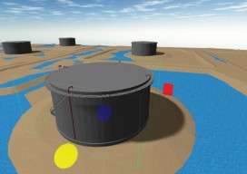
True 3D Design
New geospatial software combines the appeal of games with the rigor of applications. It’s never been done before: applying the rigor and disciplines of civil engineering, mining engineering, hydrology, and even classic survey field-to-finish to game-like 3D design. Sure, CAD operators have had 3D viewing for years, which they use to review the results of...
Advertisement