
Blog

Quarry Monitoring
In Slovenia, a team monitored slope stability in an open-pit quarry using a classic, optical precise level and Invar rod. Editor’s note: Cost-benefit analysis dictates that, for open-pit mines and quarries, steep slopes allow for the most efficient extraction of resources but at an increased risk of slope failures. This adapted paper outlines an example...

xyHt News Links: 12/18/15
New Verisurf® Software, Major Enhancements New Leica ULTRA locator: Best accuracy results in faster, more confident work Latest Blackfly GigE Vision Camera with 1.3 MP CCD from Sharp Sets New Standard for Low Cost Imaging Septentrio introduces next-generation GNSS reference receiver — PolaRx5 FLYPRO announces smartwatch-controlled XEagle drone CHC Navigation unveils i80 GNSS receiver Fugro...

Stretching Surveyors across the Water
Surveying the Gorgon Jetty Project on Barrow Island off Western Australia involved integrating structural, mechanical, and hydrographic surveying technologies and skills. Barrow Island is described by some as Australia’s answer to the Galapagos Islands. The 202 km2 (78 mi2) island and its surrounding ocean are home to diverse and unique fauna, including marsupials, reptiles, sea...
xyHt News Links: 12/10/15
SPAR 3D Call for Papers: Deadline extended to 12/16 MAPPS, NSPS Issue Call for Presentations for 2016 National Surveying and Mapping Conference CHC Navigation’s i80 GNSS Receiver is a futureproof sub-meter RTK solution
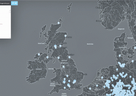
Web Mapping
Part 1, The Basics Children of the millennium will never know that there was a time before the internet when we, the cartographers, engineers, and surveyors had to relate geospatial information through the medium of paper. Although the internet has been around since the late 1980s, it wasn’t until 1996 when the world got the...

Smart Cities
They’re guided by people and powered by geospatial information. We’ve all heard the buzzword, “smart city.” But what is a smart city, and what makes it smarter than others? One of the key characteristics is the ability to make effective connections—among citizens, assets, and services—by using technology to support and improve the interaction among people...
Advertisement